Koppang geodata
Koppang (Hedmark) is a seat of a second-order administrative division; located in Norway in Europe/Oslo (GMT+2) time zone. With population of 1,182 people, there are 272 cities with bigger population in this country. Compared to other cities in Norway, 60.9% of cities are located further ↓South; 68.2% of cities are located further ←West and 92.7% of cities have lower elevation than Koppang. Note1


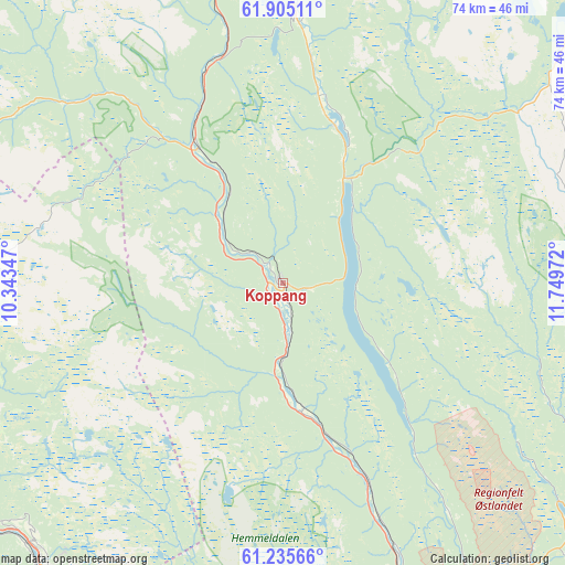
Koppang GPS coordinates[2]
61° 34' 19.884" North, 11° 2' 47.724" East
| Map corner | latitude | longitude |
|---|---|---|
| Upper-left | 61.90511°, | 10.34347° |
| Center: | 61.57219°, | 11.04659° |
| Lower-right: | 61.23566°, | 11.74972° |
| Map W x H: | 74.4×74.4 km | = 46.2×46.2mi |
| max Lat: | 71.04137° ⇑39.1% North |
| Koppang: | 61.57219° |
| min Lat: | ⇓60.9% South 58.0274° |
| min Long | Koppang | max Long |
| 4.71485° | 11.04659° | 31.11066° |
| W 68.2%⇐ | ⇒31.8% E |
Elevation
Elevation of Koppang is 360 m = 1181 ft, and this is 255.8 m = 839 ft above average elevation for this country.
| Max E: |
897 m = 2943 ft | 7.3% |
| Koppang | 360 m 1181 ft | |
| Avg. | 104.2 m = 342 ft | |
Min E: |
1 m = 3 ft | 92.7% |
See also: Norway elevation on elevation.city.
Geographical zone
Koppang is located in North temperate zone (between Tropic of Cancer and the Arctic Circle). Distance of this North polar circle is 555 km =344.9 mi to North.| Distance of | km | miles | from Koppang |
|---|---|---|---|
| North Pole | 3160.9 | 1964.1 | to North |
| Arctic Circle | 555 | 344.9 | to North |
| Tropic Cancer | 4240.3 | 2634.8 | to South |
| Equator | 6846.2 | 4254 | to South |


Nearby cities:
15 places around Koppang: (largest is in red/bold)
• Alvdal
63.4 km =39.4 mi,  339°
339°
• Bergset
35.5 km =22.1 mi,  2°
2°
• Engerdal
52.5 km =32.6 mi,  66°
66°
• Follebu
56.7 km =35.2 mi,  225°
225°
• Forset
63.3 km =39.3 mi, 229°
• Hundorp
58.6 km =36.4 mi,  268°
268°
• Innbygda
70.7 km =43.9 mi,  113°
113°
• Lillehammer
59.5 km =37 mi,  211°
211°
• Rena
51.9 km =32.2 mi,  160°
160°
• Ringebu
48.3 km =30 mi,  264°
264°
• Segalstad
57.4 km =35.7 mi, 228°
• Segalstad bru
58.2 km =36.2 mi, 228°
• Svarstad
16.8 km =10.4 mi,  32°
32°
• Tretten
48.9 km =30.4 mi, 234°
• Vinstra
68.6 km =42.6 mi, 272°
Sources, notices
• [Note1] Compared only with cities in Norway existing in our database
• [Src1] Map data: © OpenStreetMap contributors (CC-BY-SA)
• [Src2] Other city data from geonames.org with taken over terms of usage.
• [Src3] Geographical zone / Annual Mean Temperature by Robert A. Rohde @ Wikipedia
