Skaland geodata
Skaland (Troms) is a seat of a second-order administrative division; located in Norway in Europe/Oslo (GMT+2) time zone. In our database, there are 488 cities with bigger population. Compared to other cities in Norway, 95.7% of cities are located further ↓South; 93% of cities are located further ←West and 62.5% of cities have higher elevation than Skaland. Note1


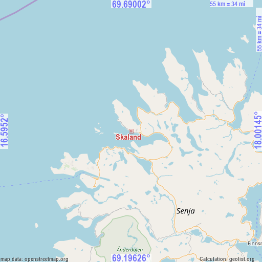
Skaland GPS coordinates[2]
69° 26' 40.416" North, 17° 17' 53.952" East
| Map corner | latitude | longitude |
|---|---|---|
| Upper-left | 69.69002°, | 16.5952° |
| Center: | 69.44456°, | 17.29832° |
| Lower-right: | 69.19626°, | 18.00145° |
| Map W x H: | 54.9×54.9 km | = 34.1×34.1mi |
| max Lat: | 71.04137° ⇑4.3% North |
| Skaland: | 69.44456° |
| min Lat: | ⇓95.7% South 58.0274° |
| min Long | Skaland | max Long |
| 4.71485° | 17.29832° | 31.11066° |
| W 93%⇐ | ⇒7% E |
Elevation
Elevation of Skaland is 25 m = 82 ft, and this is 79.2 m = 260 ft below average elevation for this country.
| Max E: |
897 m = 2943 ft | 62.5% |
| Avg. | 104.2 m = 342 ft | |
| Skaland | 25 m = 82 ft | |
Min E: |
1 m = 3 ft | 37.5% |
See also: Norway elevation on elevation.city.
Geographical zone
Skaland is located in North Frigid zone (between North Pole and Arctic Circle). Distance of this North polar circle is 320.3 km =199 mi to South.| Distance of | km | miles | from Skaland |
|---|---|---|---|
| North Pole | 2285.6 | 1420.2 | to North |
| Arctic Circle | 320.3 | 199 | to South |
| Tropic Cancer | 5115.6 | 3178.7 | to South |
| Equator | 7721.5 | 4797.9 | to South |


Nearby cities:
15 places around Skaland: (largest is in red/bold)
• Andenes
48.4 km =30.1 mi,  252°
252°
• Andselv
63.8 km =39.6 mi,  131°
131°
• Brøstadbotn
42.5 km =26.4 mi,  158°
158°
• Finnsnes
35.9 km =22.3 mi, 131°
• Gryllefjord
13.2 km =8.2 mi,  226°
226°
• Hamnvik
74.1 km =46 mi,  183°
183°
• Harstad
77.9 km =48.4 mi,  202°
202°
• Moen
62.4 km =38.8 mi,  124°
124°
• Myre
64.6 km =40.1 mi, 234°
• Setermoen
77.1 km =47.9 mi,  147°
147°
• Sjøvegan
67.1 km =41.7 mi, 161°
• Storsteinnes
79.2 km =49.2 mi,  106°
106°
• Sørreisa
47.3 km =29.4 mi, 134°
• Tromsø
68.3 km =42.4 mi,  70°
70°
• Vangsvika
34.9 km =21.7 mi, 150°
Sources, notices
• [Note1] Compared only with cities in Norway existing in our database
• [Src1] Map data: © OpenStreetMap contributors (CC-BY-SA)
• [Src2] Other city data from geonames.org with taken over terms of usage.
• [Src3] Geographical zone / Annual Mean Temperature by Robert A. Rohde @ Wikipedia
