Moen geodata
Moen (Troms) is a seat of a second-order administrative division; located in Norway in Europe/Oslo (GMT+2) time zone. With population of 840 people, there are 349 cities with bigger population in this country. Compared to other cities in Norway, 94.5% of cities are located further ↓South; 95.3% of cities are located further ←West and 53.8% of cities have higher elevation than Moen. Note1


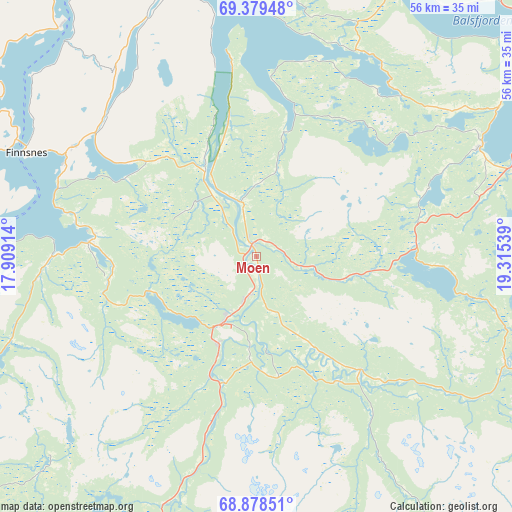
Moen GPS coordinates[2]
69° 7' 49.548" North, 18° 36' 44.136" East
| Map corner | latitude | longitude |
|---|---|---|
| Upper-left | 69.37948°, | 17.90914° |
| Center: | 69.13043°, | 18.61226° |
| Lower-right: | 68.87851°, | 19.31539° |
| Map W x H: | 55.7×55.7 km | = 34.6×34.6mi |
| max Lat: | 71.04137° ⇑5.5% North |
| Moen: | 69.13043° |
| min Lat: | ⇓94.5% South 58.0274° |
| min Long | Moen | max Long |
| 4.71485° | 18.61226° | 31.11066° |
| W 95.3%⇐ | ⇒4.7% E |
Elevation
Elevation of Moen is 36 m = 118 ft, and this is 68.2 m = 224 ft below average elevation for this country.
| Max E: |
897 m = 2943 ft | 53.8% |
| Avg. | 104.2 m = 342 ft | |
| Moen | 36 m = 118 ft | |
Min E: |
1 m = 3 ft | 46.2% |
See also: Norway elevation on elevation.city.
Geographical zone
Moen is located in North Frigid zone (between North Pole and Arctic Circle). Distance of this North polar circle is 285.4 km =177.3 mi to South.| Distance of | km | miles | from Moen |
|---|---|---|---|
| North Pole | 2320.5 | 1441.9 | to North |
| Arctic Circle | 285.4 | 177.3 | to South |
| Tropic Cancer | 5080.7 | 3157 | to South |
| Equator | 7686.6 | 4776.2 | to South |


Nearby cities:
15 places around Moen: (largest is in red/bold)
• Andselv
8.2 km =5.1 mi,  208°
208°
• Brøstadbotn
36.7 km =22.8 mi,  262°
262°
• Finnsnes
27.3 km =17 mi,  293°
293°
• Gratangen
65.1 km =40.5 mi, 214°
• Gryllefjord
66.7 km =41.4 mi, 292°
• Hamnvik
69.5 km =43.2 mi,  235°
235°
• Hatteng
55.4 km =34.4 mi,  73°
73°
• Setermoen
31.7 km =19.7 mi,  199°
199°
• Sjøvegan
41.8 km =26 mi,  226°
226°
• Skaland
62.4 km =38.8 mi,  304°
304°
• Storsteinnes
27.5 km =17.1 mi,  63°
63°
• Sørreisa
18.3 km =11.4 mi,  275°
275°
• Tennevoll
53.4 km =33.2 mi,  217°
217°
• Tromsø
59.2 km =36.8 mi,  13°
13°
• Vangsvika
35 km =21.7 mi, 277°
Sources, notices
• [Note1] Compared only with cities in Norway existing in our database
• [Src1] Map data: © OpenStreetMap contributors (CC-BY-SA)
• [Src2] Other city data from geonames.org with taken over terms of usage.
• [Src3] Geographical zone / Annual Mean Temperature by Robert A. Rohde @ Wikipedia
