Førde geodata
Førde (Sogn og Fjordane) is a seat of a second-order administrative division; located in Norway in Europe/Oslo (GMT+2) time zone. With population of 8,510 people, there are 55 cities with bigger population in this country. Compared to other cities in Norway, 60.1% of cities are located further ↓South; 84.5% of cities are located further →East and 60.1% of cities have higher elevation than Førde. Note1


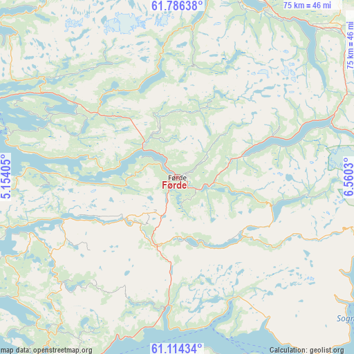
Førde GPS coordinates[2]
61° 27' 7.812" North, 5° 51' 25.812" East
| Map corner | latitude | longitude |
|---|---|---|
| Upper-left | 61.78638°, | 5.15405° |
| Center: | 61.45217°, | 5.85717° |
| Lower-right: | 61.11434°, | 6.5603° |
| Map W x H: | 74.7×74.7 km | = 46.4×46.4mi |
| max Lat: | 71.04137° ⇑39.9% North |
| Førde: | 61.45217° |
| min Lat: | ⇓60.1% South 58.0274° |
| min Long | Førde | max Long |
| 4.71485° | 5.85717° | 31.11066° |
| W 15.5%⇐ | ⇒84.5% E |
Elevation
Elevation of Førde is 27 m = 89 ft, and this is 77.2 m = 253 ft below average elevation for this country.
| Max E: |
897 m = 2943 ft | 60.1% |
| Avg. | 104.2 m = 342 ft | |
| Førde | 27 m = 89 ft | |
Min E: |
1 m = 3 ft | 39.9% |
See also: Norway elevation on elevation.city.
Geographical zone
Førde is located in North temperate zone (between Tropic of Cancer and the Arctic Circle). Distance of this North polar circle is 568.3 km =353.1 mi to North.| Distance of | km | miles | from Førde |
|---|---|---|---|
| North Pole | 3174.2 | 1972.4 | to North |
| Arctic Circle | 568.3 | 353.1 | to North |
| Tropic Cancer | 4226.9 | 2626.5 | to South |
| Equator | 6832.8 | 4245.7 | to South |


Nearby cities:
15 places around Førde: (largest is in red/bold)
• Askvoll
43.9 km =27.3 mi,  254°
254°
• Balestrand
45.2 km =28.1 mi,  126°
126°
• Dale
26.2 km =16.3 mi, 247°
• Florø
46.7 km =29 mi,  290°
290°
• Hermansverk
60.8 km =37.8 mi,  119°
119°
• Hyllestad
43.3 km =26.9 mi,  223°
223°
• Høyanger
28.2 km =17.5 mi,  154°
154°
• Naustdal
9.9 km =6.2 mi,  311°
311°
• Nordfjordeid
51.6 km =32.1 mi,  7°
7°
• Sandane
40.4 km =25.1 mi,  27°
27°
• Sande
14.5 km =9 mi,  192°
192°
• Skei
35.6 km =22.1 mi,  68°
68°
• Svelgen
46.1 km =28.6 mi,  319°
319°
• Vik
58.4 km =36.3 mi,  138°
138°
• Vikøyri
56 km =34.8 mi, 136°
Sources, notices
• [Note1] Compared only with cities in Norway existing in our database
• [Src1] Map data: © OpenStreetMap contributors (CC-BY-SA)
• [Src2] Other city data from geonames.org with taken over terms of usage.
• [Src3] Geographical zone / Annual Mean Temperature by Robert A. Rohde @ Wikipedia
