Sande geodata
Sande (Sogn og Fjordane) is a seat of a second-order administrative division; located in Norway in Europe/Oslo (GMT+2) time zone. With population of 542 people, there are 448 cities with bigger population in this country. Compared to other cities in Norway, 59.5% of cities are located further ↓South; 85.8% of cities are located further →East and 67.7% of cities have lower elevation than Sande. Note1


Sande GPS coordinates[2]
61° 19' 30.396" North, 5° 47' 51.828" East
| Map corner | latitude | longitude |
|---|---|---|
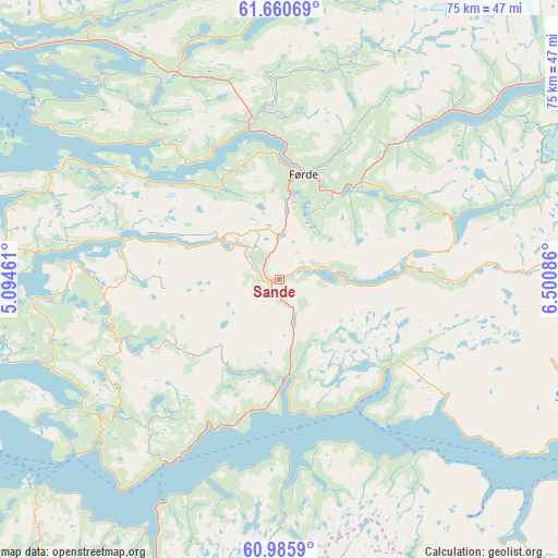
| Upper-left | 61.66069°, | 5.09461° |
| Center: | 61.32511°, | 5.79773° |
| Lower-right: | 60.9859°, | 6.50086° |
| Map W x H: | 75×75 km | = 46.6×46.6mi |
| max Lat: | 71.04137° ⇑40.5% North |
| Sande: | 61.32511° |
| min Lat: | ⇓59.5% South 58.0274° |
| min Long | Sande | max Long |
| 4.71485° | 5.79773° | 31.11066° |
| W 14.2%⇐ | ⇒85.8% E |
Elevation
Elevation of Sande is 110 m = 361 ft, and this is 5.8 m = 19 ft above average elevation for this country.
| Max E: |
897 m = 2943 ft | 32.3% |
| Sande | 110 m 361 ft | |
| Avg. | 104.2 m = 342 ft | |
Min E: |
1 m = 3 ft | 67.7% |
See also: Norway elevation on elevation.city.
Geographical zone
Sande is located in North temperate zone (between Tropic of Cancer and the Arctic Circle). Distance of this North polar circle is 582.5 km =361.9 mi to North.| Distance of | km | miles | from Sande |
|---|---|---|---|
| North Pole | 3188.3 | 1981.1 | to North |
| Arctic Circle | 582.5 | 361.9 | to North |
| Tropic Cancer | 4212.8 | 2617.7 | to South |
| Equator | 6818.7 | 4236.9 | to South |


Nearby cities:
15 places around Sande: (largest is in red/bold)
• Askvoll
39.3 km =24.4 mi,  273°
273°
• Balestrand
41.5 km =25.8 mi,  108°
108°
• Dale
21.6 km =13.4 mi,  281°
281°
• Eivindvik
54.4 km =33.8 mi,  225°
225°
• Florø
50.8 km =31.6 mi,  306°
306°
• Førde
14.5 km =9 mi,  12°
12°
• Hyllestad
31.8 km =19.8 mi,  237°
237°
• Høyanger
19 km =11.8 mi,  126°
126°
• Mo
56.6 km =35.2 mi,  179°
179°
• Naustdal
21.1 km =13.1 mi,  348°
348°
• Sandane
54.5 km =33.9 mi,  23°
23°
• Skei
45.4 km =28.2 mi,  52°
52°
• Svelgen
56.1 km =34.9 mi,  331°
331°
• Vik
51.3 km =31.9 mi, 125°
• Vikøyri
49.5 km =30.8 mi,  122°
122°
Sources, notices
• [Note1] Compared only with cities in Norway existing in our database
• [Src1] Map data: © OpenStreetMap contributors (CC-BY-SA)
• [Src2] Other city data from geonames.org with taken over terms of usage.
• [Src3] Geographical zone / Annual Mean Temperature by Robert A. Rohde @ Wikipedia
