Ål geodata
Ål (Buskerud) is a seat of a second-order administrative division; located in Norway in Europe/Oslo (GMT+2) time zone. With population of 2,278 people, there are 174 cities with bigger population in this country. Compared to other cities in Norway, 50.2% of cities are located further ↓South; 63.4% of cities are located further →East and 95.3% of cities have lower elevation than Ål. Note1


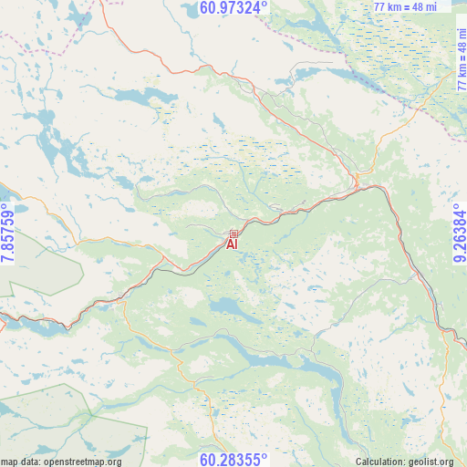
Ål GPS coordinates[2]
60° 37' 48.864" North, 8° 33' 38.556" East
| Map corner | latitude | longitude |
|---|---|---|
| Upper-left | 60.97324°, | 7.85759° |
| Center: | 60.63024°, | 8.56071° |
| Lower-right: | 60.28355°, | 9.26384° |
| Map W x H: | 76.7×76.7 km | = 47.7×47.7mi |
| max Lat: | 71.04137° ⇑49.8% North |
| Ål: | 60.63024° |
| min Lat: | ⇓50.2% South 58.0274° |
| min Long | Ål | max Long |
| 4.71485° | 8.56071° | 31.11066° |
| W 36.6%⇐ | ⇒63.4% E |
Elevation
Elevation of Ål is 440 m = 1444 ft, and this is 335.8 m = 1102 ft above average elevation for this country.
| Max E: |
897 m = 2943 ft | 4.7% |
| Ål | 440 m 1444 ft | |
| Avg. | 104.2 m = 342 ft | |
Min E: |
1 m = 3 ft | 95.3% |
See also: Norway elevation on elevation.city.
Geographical zone
Ål is located in North temperate zone (between Tropic of Cancer and the Arctic Circle). Distance of this North polar circle is 659.7 km =409.9 mi to North.| Distance of | km | miles | from Ål |
|---|---|---|---|
| North Pole | 3265.6 | 2029.1 | to North |
| Arctic Circle | 659.7 | 409.9 | to North |
| Tropic Cancer | 4135.5 | 2569.7 | to South |
| Equator | 6741.5 | 4189 | to South |


Nearby cities:
15 places around Ål: (largest is in red/bold)
• Aurdal
56.7 km =35.2 mi,  54°
54°
• Bagn
58 km =36 mi,  68°
68°
• Fagernes
53.8 km =33.4 mi,  42°
42°
• Flå
54.1 km =33.6 mi,  114°
114°
• Geilo
22.2 km =13.8 mi,  241°
241°
• Gol
22.4 km =13.9 mi, 69°
• Heggenes
63.4 km =39.4 mi,  25°
25°
• Hemsedal
25.9 km =16.1 mi,  359°
359°
• Hol
14.6 km =9.1 mi,  263°
263°
• Leira
54.9 km =34.1 mi, 46°
• Nesbyen
30.4 km =18.9 mi,  103°
103°
• Rødberg
45.6 km =28.3 mi,  152°
152°
• Slidre
55.8 km =34.7 mi,  24°
24°
• Trøim
25.7 km =16 mi,  0°
0°
• Vang
55 km =34.2 mi, 0°
Sources, notices
• [Note1] Compared only with cities in Norway existing in our database
• [Src1] Map data: © OpenStreetMap contributors (CC-BY-SA)
• [Src2] Other city data from geonames.org with taken over terms of usage.
• [Src3] Geographical zone / Annual Mean Temperature by Robert A. Rohde @ Wikipedia
