Fagernes geodata
Fagernes (Oppland) is a seat of a second-order administrative division; located in Norway in Europe/Oslo (GMT+2) time zone. With population of 1,788 people, there are 223 cities with bigger population in this country. Compared to other cities in Norway, 55.5% of cities are located further ↓South; 58.1% of cities are located further →East and 93.2% of cities have lower elevation than Fagernes. Note1


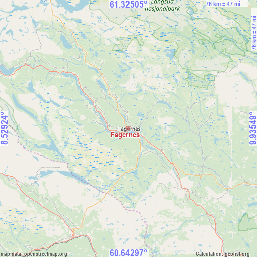
Fagernes GPS coordinates[2]
60° 59' 9.024" North, 9° 13' 56.496" East
| Map corner | latitude | longitude |
|---|---|---|
| Upper-left | 61.32505°, | 8.52924° |
| Center: | 60.98584°, | 9.23236° |
| Lower-right: | 60.64297°, | 9.93549° |
| Map W x H: | 75.8×75.8 km | = 47.1×47.1mi |
| max Lat: | 71.04137° ⇑44.5% North |
| Fagernes: | 60.98584° |
| min Lat: | ⇓55.5% South 58.0274° |
| min Long | Fagernes | max Long |
| 4.71485° | 9.23236° | 31.11066° |
| W 41.9%⇐ | ⇒58.1% E |
Elevation
Elevation of Fagernes is 374 m = 1227 ft, and this is 269.8 m = 885 ft above average elevation for this country.
| Max E: |
897 m = 2943 ft | 6.8% |
| Fagernes | 374 m 1227 ft | |
| Avg. | 104.2 m = 342 ft | |
Min E: |
1 m = 3 ft | 93.2% |
See also: Norway elevation on elevation.city.
Geographical zone
Fagernes is located in North temperate zone (between Tropic of Cancer and the Arctic Circle). Distance of this North polar circle is 620.2 km =385.4 mi to North.| Distance of | km | miles | from Fagernes |
|---|---|---|---|
| North Pole | 3226.1 | 2004.6 | to North |
| Arctic Circle | 620.2 | 385.4 | to North |
| Tropic Cancer | 4175.1 | 2594.3 | to South |
| Equator | 6781 | 4213.5 | to South |


Nearby cities:
15 places around Fagernes: (largest is in red/bold)
• Aurdal
12 km =7.5 mi,  124°
124°
• Bagn
25.1 km =15.6 mi,  136°
136°
• Bruflat
24.6 km =15.3 mi, 116°
• Dokka
48.5 km =30.1 mi,  110°
110°
• Forset
54.6 km =33.9 mi,  63°
63°
• Gol
35.2 km =21.9 mi,  206°
206°
• Heggenes
19.6 km =12.2 mi,  333°
333°
• Hemsedal
39.2 km =24.4 mi,  249°
249°
• Leira
3.8 km =2.4 mi, 117°
• Nesbyen
47 km =29.2 mi,  188°
188°
• Segalstad bru
59.6 km =37 mi, 63°
• Slidre
17.7 km =11 mi,  310°
310°
• Trøim
38.6 km =24 mi, 248°
• Vang
38.7 km =24 mi,  293°
293°
• Ål
53.8 km =33.4 mi,  222°
222°
Sources, notices
• [Note1] Compared only with cities in Norway existing in our database
• [Src1] Map data: © OpenStreetMap contributors (CC-BY-SA)
• [Src2] Other city data from geonames.org with taken over terms of usage.
• [Src3] Geographical zone / Annual Mean Temperature by Robert A. Rohde @ Wikipedia
