Heggenes geodata
Heggenes (Oppland) is a seat of a second-order administrative division; located in Norway in Europe/Oslo (GMT+2) time zone. In our database, there are 488 cities with bigger population. Compared to other cities in Norway, 57% of cities are located further ↓South; 59.3% of cities are located further →East and 97.5% of cities have lower elevation than Heggenes. Note1


Heggenes GPS coordinates[2]
61° 8' 37.788" North, 9° 4' 9.912" East
| Map corner | latitude | longitude |
|---|---|---|
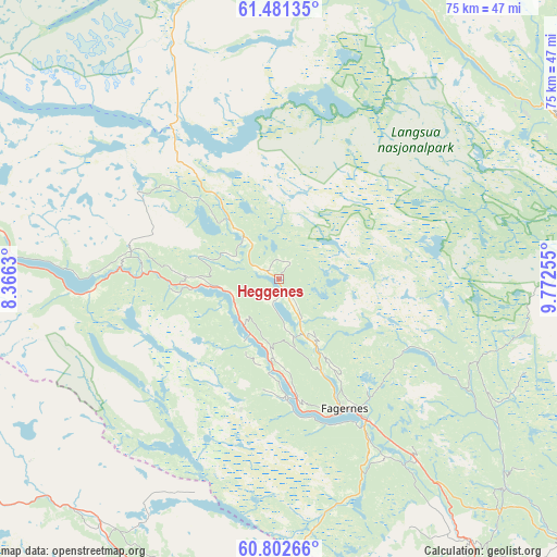
| Upper-left | 61.48135°, | 8.3663° |
| Center: | 61.14383°, | 9.06942° |
| Lower-right: | 60.80266°, | 9.77255° |
| Map W x H: | 75.5×75.5 km | = 46.9×46.9mi |
| max Lat: | 71.04137° ⇑43% North |
| Heggenes: | 61.14383° |
| min Lat: | ⇓57% South 58.0274° |
| min Long | Heggenes | max Long |
| 4.71485° | 9.06942° | 31.11066° |
| W 40.7%⇐ | ⇒59.3% E |
Elevation
Elevation of Heggenes is 540 m = 1772 ft, and this is 435.8 m = 1430 ft above average elevation for this country.
| Max E: |
897 m = 2943 ft | 2.5% |
| Heggenes | 540 m 1772 ft | |
| Avg. | 104.2 m = 342 ft | |
Min E: |
1 m = 3 ft | 97.5% |
See also: Norway elevation on elevation.city.
Geographical zone
Heggenes is located in North temperate zone (between Tropic of Cancer and the Arctic Circle). Distance of this North polar circle is 602.6 km =374.4 mi to North.| Distance of | km | miles | from Heggenes |
|---|---|---|---|
| North Pole | 3208.5 | 1993.7 | to North |
| Arctic Circle | 602.6 | 374.4 | to North |
| Tropic Cancer | 4192.6 | 2605.2 | to South |
| Equator | 6798.6 | 4224.5 | to South |


Nearby cities:
15 places around Heggenes: (largest is in red/bold)
• Aurdal
30.7 km =19.1 mi,  142°
142°
• Bagn
44.2 km =27.5 mi, 143°
• Bruflat
42 km =26.1 mi,  132°
132°
• Fagernes
19.6 km =12.2 mi,  153°
153°
• Forset
58 km =36 mi,  83°
83°
• Gol
49.6 km =30.8 mi,  187°
187°
• Hemsedal
41.8 km =26 mi,  221°
221°
• Leira
22.8 km =14.2 mi, 147°
• Segalstad
63.2 km =39.3 mi, 80°
• Segalstad bru
62.5 km =38.8 mi, 81°
• Slidre
7.8 km =4.8 mi, 217°
• Trøim
41.5 km =25.8 mi, 220°
• Vang
26.7 km =16.6 mi,  265°
265°
• Vinstra
61.9 km =38.5 mi,  35°
35°
• Ål
63.4 km =39.4 mi,  205°
205°
Sources, notices
• [Note1] Compared only with cities in Norway existing in our database
• [Src1] Map data: © OpenStreetMap contributors (CC-BY-SA)
• [Src2] Other city data from geonames.org with taken over terms of usage.
• [Src3] Geographical zone / Annual Mean Temperature by Robert A. Rohde @ Wikipedia
