Evje geodata
Evje (Aust-Agder) is a seat of a second-order administrative division; located in Norway in Europe/Oslo (GMT+2) time zone. In our database, there are 488 cities with bigger population. Compared to other cities in Norway, 94.3% of cities are located further ↑North; 68.4% of cities are located further →East and 82.3% of cities have lower elevation than Evje. Note1


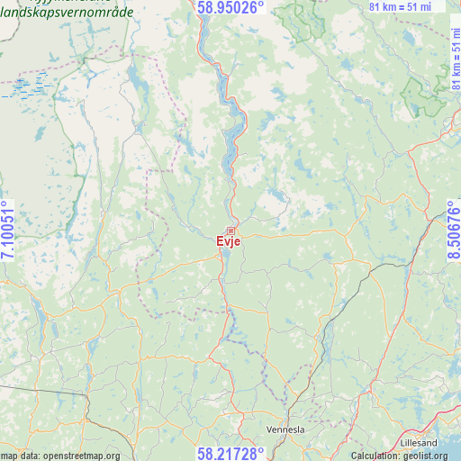
Evje GPS coordinates[2]
58° 35' 8.484" North, 7° 48' 13.068" East
| Map corner | latitude | longitude |
|---|---|---|
| Upper-left | 58.95026°, | 7.10051° |
| Center: | 58.58569°, | 7.80363° |
| Lower-right: | 58.21728°, | 8.50676° |
| Map W x H: | 81.5×81.5 km | = 50.6×50.6mi |
| max Lat: | 71.04137° ⇑94.3% North |
| Evje: | 58.58569° |
| min Lat: | ⇓5.7% South 58.0274° |
| min Long | Evje | max Long |
| 4.71485° | 7.80363° | 31.11066° |
| W 31.6%⇐ | ⇒68.4% E |
Elevation
Elevation of Evje is 185 m = 607 ft, and this is 80.8 m = 265 ft above average elevation for this country.
| Max E: |
897 m = 2943 ft | 17.7% |
| Evje | 185 m 607 ft | |
| Avg. | 104.2 m = 342 ft | |
Min E: |
1 m = 3 ft | 82.3% |
See also: Norway elevation on elevation.city.
Geographical zone
Evje is located in North temperate zone (between Tropic of Cancer and the Arctic Circle). Distance of this North polar circle is 887.1 km =551.2 mi to North.| Distance of | km | miles | from Evje |
|---|---|---|---|
| North Pole | 3492.9 | 2170.4 | to North |
| Arctic Circle | 887.1 | 551.2 | to North |
| Tropic Cancer | 3908.2 | 2428.4 | to South |
| Equator | 6514.1 | 4047.7 | to South |


Nearby cities:
15 places around Evje: (largest is in red/bold)
• Birkeland
37.7 km =23.4 mi,  138°
138°
• Birketveit
15.5 km =9.6 mi,  154°
154°
• Blakstad
49.7 km =30.9 mi,  100°
100°
• Bygland
27 km =16.8 mi,  359°
359°
• Helland
46.6 km =29 mi,  200°
200°
• Justvik
45.2 km =28.1 mi,  162°
162°
• Konsmo
42.4 km =26.3 mi,  217°
217°
• Kristiansand
50.1 km =31.1 mi,  167°
167°
• Kyrkjebygda
22.8 km =14.2 mi,  278°
278°
• Nodeland
47.9 km =29.8 mi,  177°
177°
• Strai
44.7 km =27.8 mi, 170°
• Tingvatn
41.2 km =25.6 mi,  235°
235°
• Tveit
43.3 km =26.9 mi, 154°
• Vennesla
36.6 km =22.7 mi, 164°
• Åmli
44.1 km =27.4 mi,  63°
63°
Sources, notices
• [Note1] Compared only with cities in Norway existing in our database
• [Src1] Map data: © OpenStreetMap contributors (CC-BY-SA)
• [Src2] Other city data from geonames.org with taken over terms of usage.
• [Src3] Geographical zone / Annual Mean Temperature by Robert A. Rohde @ Wikipedia
