Jaleshwar geodata
Jaleshwar (Central Region) is a populated place; located in Nepal in Asia/Kathmandu (GMT+5.75) time zone. With population of 23,573 people, there are 30 cities with bigger population in this country. Compared to other cities in Nepal, 94.6% of cities are located further ↑North; 74.3% of cities are located further ←West and 100% of cities have higher elevation than Jaleshwar. Note1


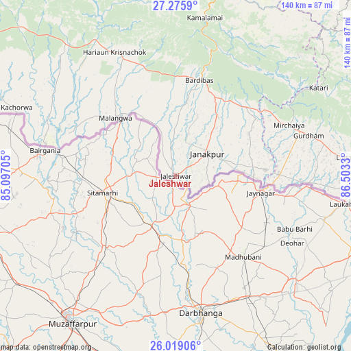
Jaleshwar GPS coordinates[2]
26° 38' 57.156" North, 85° 48' 0.612" East
| Map corner | latitude | longitude |
|---|---|---|
| Upper-left | 27.2759°, | 85.09705° |
| Center: | 26.64921°, | 85.80017° |
| Lower-right: | 26.01906°, | 86.5033° |
| Map W x H: | 139.7×139.7 km | = 86.8×86.8mi |
| max Lat: | 30.04651° ⇑94.6% North |
| Jaleshwar: | 26.64921° |
| min Lat: | ⇓5.4% South 26.45505° |
| min Long | Jaleshwar | max Long |
| 80.17715° | 85.80017° | 88.09436° |
| W 74.3%⇐ | ⇒25.7% E |
Elevation
Elevation of Jaleshwar is 72 m = 236 ft, and this is 1103.2 m = 3619 ft below average elevation for this country.
| Max E: |
5251 m = 17228 ft | 100% |
| Avg. | 1175.2 m = 3856 ft | |
| Jaleshwar | 72 m = 236 ft | |
Min E: |
72 m = 236 ft | 0% |
See also: Nepal elevation on elevation.city.
Geographical zone
Jaleshwar is located in North temperate zone (between Tropic of Cancer and the Arctic Circle). Distance of this Northern Tropic circle is 357.2 km =222 mi to South.| Distance of | km | miles | from Jaleshwar |
|---|---|---|---|
| North Pole | 7043.9 | 4376.9 | to North |
| Arctic Circle | 4438.1 | 2757.7 | to North |
| Tropic Cancer | 357.2 | 222 | to South |
| Equator | 2963.1 | 1841.2 | to South |


Nearby cities:
15 places around Jaleshwar: (largest is in red/bold)
• Banepā
112.7 km =70 mi,  345°
345°
• Birgañj
100 km =62.1 mi,  294°
294°
• Dhulikhel
111.1 km =69 mi, 346°
• Gaur
53.4 km =33.2 mi,  283°
283°
• Hari Bdr Tamang House
114 km =70.8 mi,  342°
342°
• Janakpur
15.3 km =9.5 mi,  54°
54°
• Lahān
68.3 km =42.4 mi,  83°
83°
• Malaṅgawā
33.2 km =20.6 mi,  313°
313°
• Panauti
107.6 km =66.9 mi, 345°
• Panauti̇̄
107.8 km =67 mi, 344°
• Rājbirāj
95 km =59 mi,  97°
97°
• Rāmechhāp
80.4 km =50 mi,  20°
20°
• Siraha
40.5 km =25.2 mi,  89°
89°
• Triyuga
90.7 km =56.4 mi, 79°
• kankrabari Dovan
114 km =70.8 mi, 342°
Sources, notices
• [Note1] Compared only with cities in Nepal existing in our database
• [Src1] Map data: © OpenStreetMap contributors (CC-BY-SA)
• [Src2] Other city data from geonames.org with taken over terms of usage.
• [Src3] Geographical zone / Annual Mean Temperature by Robert A. Rohde @ Wikipedia
