Tulsīpur geodata
Tulsīpur (Mid Western) is a populated place; located in Nepal in Asia/Kathmandu (GMT+5.75) time zone. With population of 39,058 people, there are 22 cities with bigger population in this country. Compared to other cities in Nepal, 63.5% of cities are located further ↓South; 74.3% of cities are located further →East and 60.8% of cities have higher elevation than Tulsīpur. Note1


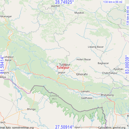
Tulsīpur GPS coordinates[2]
28° 7' 51.564" North, 82° 17' 50.136" East
| Map corner | latitude | longitude |
|---|---|---|
| Upper-left | 28.74925°, | 81.59414° |
| Center: | 28.13099°, | 82.29726° |
| Lower-right: | 27.50914°, | 83.00039° |
| Map W x H: | 137.9×137.9 km | = 85.7×85.7mi |
| max Lat: | 30.04651° ⇑36.5% North |
| Tulsīpur: | 28.13099° |
| min Lat: | ⇓63.5% South 26.45505° |
| min Long | Tulsīpur | max Long |
| 80.17715° | 82.29726° | 88.09436° |
| W 25.7%⇐ | ⇒74.3% E |
Elevation
Elevation of Tulsīpur is 675 m = 2215 ft, and this is 500.2 m = 1641 ft below average elevation for this country.
| Max E: |
5251 m = 17228 ft | 60.8% |
| Avg. | 1175.2 m = 3856 ft | |
| Tulsīpur | 675 m = 2215 ft | |
Min E: |
72 m = 236 ft | 39.2% |
See also: Nepal elevation on elevation.city.
Geographical zone
Tulsīpur is located in North temperate zone (between Tropic of Cancer and the Arctic Circle). Distance of this Northern Tropic circle is 522 km =324.4 mi to South.| Distance of | km | miles | from Tulsīpur |
|---|---|---|---|
| North Pole | 6879.2 | 4274.5 | to North |
| Arctic Circle | 4273.3 | 2655.3 | to North |
| Tropic Cancer | 522 | 324.4 | to South |
| Equator | 3127.9 | 1943.6 | to South |


Nearby cities:
15 places around Tulsīpur: (largest is in red/bold)
• Bardiyā
94.4 km =58.7 mi,  281°
281°
• Besisahar
16.1 km =10 mi,  44°
44°
• Bhojpur
55.6 km =34.5 mi,  247°
247°
• Birendranagar
83.4 km =51.8 mi,  308°
308°
• Butwāl
122.8 km =76.3 mi,  112°
112°
• Bāglung
127.6 km =79.3 mi,  82°
82°
• Dailekh
97.9 km =60.8 mi,  324°
324°
• Gulariyā
93.7 km =58.2 mi, 275°
• Jumla
127.7 km =79.3 mi,  355°
355°
• Nepalgunj
67.4 km =41.9 mi,  262°
262°
• Pyūthān
57.8 km =35.9 mi,  94°
94°
• Salyān
30.2 km =18.8 mi,  335°
335°
• Surkhet
66.5 km =41.3 mi, 310°
• Tānsen
126.1 km =78.4 mi,  103°
103°
• Ṭikāpur
123.6 km =76.8 mi,  290°
290°
Sources, notices
• [Note1] Compared only with cities in Nepal existing in our database
• [Src1] Map data: © OpenStreetMap contributors (CC-BY-SA)
• [Src2] Other city data from geonames.org with taken over terms of usage.
• [Src3] Geographical zone / Annual Mean Temperature by Robert A. Rohde @ Wikipedia
