Besisahar geodata
Besisahar is a populated place; located in Nepal in Asia/Kathmandu (GMT+5.75) time zone. With population of 5,427 people, there are 49 cities with bigger population in this country. Compared to other cities in Nepal, 67.6% of cities are located further ↓South; 73% of cities are located further →East and 60.8% of cities have lower elevation than Besisahar. Note1


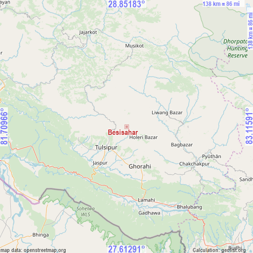
Besisahar GPS coordinates[2]
28° 14' 3.012" North, 82° 24' 46.008" East
| Map corner | latitude | longitude |
|---|---|---|
| Upper-left | 28.85183°, | 81.70966° |
| Center: | 28.23417°, | 82.41278° |
| Lower-right: | 27.61291°, | 83.11591° |
| Map W x H: | 137.8×137.8 km | = 85.6×85.6mi |
| max Lat: | 30.04651° ⇑32.4% North |
| Besisahar: | 28.23417° |
| min Lat: | ⇓67.6% South 26.45505° |
| min Long | Besisahar | max Long |
| 80.17715° | 82.41278° | 88.09436° |
| W 27%⇐ | ⇒73% E |
Elevation
Elevation of Besisahar is 1334 m = 4377 ft, and this is 158.8 m = 521 ft above average elevation for this country.
| Max E: |
5251 m = 17228 ft | 39.2% |
| Besisahar | 1334 m 4377 ft | |
| Avg. | 1175.2 m = 3856 ft | |
Min E: |
72 m = 236 ft | 60.8% |
See also: Nepal elevation on elevation.city.
Geographical zone
Besisahar is located in North temperate zone (between Tropic of Cancer and the Arctic Circle). Distance of this Northern Tropic circle is 533.4 km =331.4 mi to South.| Distance of | km | miles | from Besisahar |
|---|---|---|---|
| North Pole | 6867.7 | 4267.4 | to North |
| Arctic Circle | 4261.8 | 2648.2 | to North |
| Tropic Cancer | 533.4 | 331.4 | to South |
| Equator | 3139.3 | 1950.7 | to South |


Nearby cities:
15 places around Besisahar: (largest is in red/bold)
• Bardiyā
104 km =64.6 mi,  274°
274°
• Bhojpur
70.8 km =44 mi,  242°
242°
• Birendranagar
86.5 km =53.7 mi,  298°
298°
• Butwāl
117.7 km =73.1 mi,  120°
120°
• Bāglung
115.4 km =71.7 mi,  87°
87°
• Chitre
126.9 km =78.9 mi,  80°
80°
• Dailekh
96.5 km =60 mi,  314°
314°
• Gulariyā
104.6 km =65 mi, 268°
• Jumla
117.8 km =73.2 mi,  349°
349°
• Nepalgunj
80.7 km =50.1 mi,  255°
255°
• Pyūthān
49 km =30.4 mi,  109°
109°
• Salyān
28.7 km =17.8 mi, 304°
• Surkhet
69.6 km =43.2 mi, 296°
• Tulsīpur
16.1 km =10 mi,  224°
224°
• Tānsen
118.5 km =73.6 mi, 110°
Sources, notices
• [Note1] Compared only with cities in Nepal existing in our database
• [Src1] Map data: © OpenStreetMap contributors (CC-BY-SA)
• [Src2] Other city data from geonames.org with taken over terms of usage.
• [Src3] Geographical zone / Annual Mean Temperature by Robert A. Rohde @ Wikipedia
