Bhadrapur geodata
Bhadrapur (Eastern Region) is a populated place; located in Nepal in Asia/Kathmandu (GMT+5.75) time zone. With population of 19,523 people, there are 38 cities with bigger population in this country. Compared to other cities in Nepal, 97.3% of cities are located further ↑North; 100% of cities are located further ←West and 87.8% of cities have higher elevation than Bhadrapur. Note1


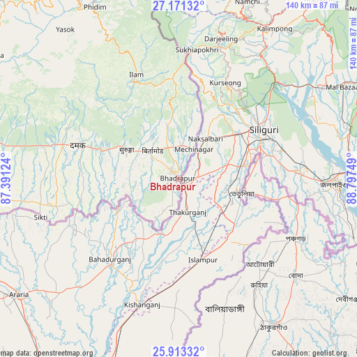
Bhadrapur GPS coordinates[2]
26° 32' 38.544" North, 88° 5' 39.696" East
| Map corner | latitude | longitude |
|---|---|---|
| Upper-left | 27.17132°, | 87.39124° |
| Center: | 26.54404°, | 88.09436° |
| Lower-right: | 25.91332°, | 88.79749° |
| Map W x H: | 139.9×139.9 km | = 86.9×86.9mi |
| max Lat: | 30.04651° ⇑97.3% North |
| Bhadrapur: | 26.54404° |
| min Lat: | ⇓2.7% South 26.45505° |
| min Long | Bhadrapur | max Long |
| 80.17715° | 88.09436° | 88.09436° |
| W 100%⇐ | ⇒0% E |
Elevation
Elevation of Bhadrapur is 91 m = 299 ft, and this is 1084.2 m = 3557 ft below average elevation for this country.
| Max E: |
5251 m = 17228 ft | 87.8% |
| Avg. | 1175.2 m = 3856 ft | |
| Bhadrapur | 91 m = 299 ft | |
Min E: |
72 m = 236 ft | 12.2% |
See also: Nepal elevation on elevation.city.
Geographical zone
Bhadrapur is located in North temperate zone (between Tropic of Cancer and the Arctic Circle). Distance of this Northern Tropic circle is 345.5 km =214.7 mi to South.| Distance of | km | miles | from Bhadrapur |
|---|---|---|---|
| North Pole | 7055.6 | 4384.1 | to North |
| Arctic Circle | 4449.8 | 2765 | to North |
| Tropic Cancer | 345.5 | 214.7 | to South |
| Equator | 2951.4 | 1833.9 | to South |


Nearby cities:
15 places around Bhadrapur: (largest is in red/bold)
• Bhojpur
125.2 km =77.8 mi,  303°
303°
• Biratnagar
82.6 km =51.3 mi,  263°
263°
• Dhankutā
90 km =55.9 mi, 302°
• Dharān
86.3 km =53.6 mi,  290°
290°
• Ilām
43.8 km =27.2 mi,  337°
337°
• Inaruwa
94.4 km =58.7 mi,  274°
274°
• Janakpur
216.5 km =134.5 mi,  275°
275°
• Khanbari
127.6 km =79.3 mi,  316°
316°
• Lahān
161.4 km =100.3 mi, 276°
• Lobujya
201 km =124.9 mi, 321°
• Namche Bazar
196 km =121.8 mi, 315°
• Rājbirāj
133.9 km =83.2 mi, 269°
• Siraha
187.9 km =116.8 mi, 273°
• Titahari
82.6 km =51.3 mi, 279°
• Triyuga
141.4 km =87.9 mi, 281°
Sources, notices
• [Note1] Compared only with cities in Nepal existing in our database
• [Src1] Map data: © OpenStreetMap contributors (CC-BY-SA)
• [Src2] Other city data from geonames.org with taken over terms of usage.
• [Src3] Geographical zone / Annual Mean Temperature by Robert A. Rohde @ Wikipedia
