Sohar geodata
Sohar (Al Batinah North) is a seat of a first-order administrative division; located in Oman in Asia/Muscat (GMT+4) time zone. With population of 108,274 people, there are 4 cities with bigger population in this country. Compared to other cities in Oman, 83.9% of cities are located further ↓South; 64.5% of cities are located further →East and 74.2% of cities have higher elevation than Sohar. Note1


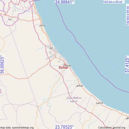
Sohar GPS coordinates[2]
24° 20' 50.82" North, 56° 42' 33.732" East
| Map corner | latitude | longitude |
|---|---|---|
| Upper-left | 24.98641°, | 56.00625° |
| Center: | 24.34745°, | 56.70937° |
| Lower-right: | 23.70525°, | 57.4125° |
| Map W x H: | 142.5×142.5 km | = 88.5×88.5mi |
| max Lat: | 26.19778° ⇑16.1% North |
| Sohar: | 24.34745° |
| min Lat: | ⇓83.9% South 17.01505° |
| min Long | Sohar | max Long |
| 52.66042° | 56.70937° | 59.52889° |
| W 35.5%⇐ | ⇒64.5% E |
Elevation
Elevation of Sohar is 12 m = 39 ft, and this is 194.7 m = 639 ft below average elevation for this country.
| Max E: |
684 m = 2244 ft | 74.2% |
| Avg. | 206.7 m = 678 ft | |
| Sohar | 12 m = 39 ft | |
Min E: |
1 m = 3 ft | 25.8% |
See also: Sohar elevation on elevation.city.
Geographical zone
Sohar is located in North temperate zone (between Tropic of Cancer and the Arctic Circle). Distance of this Northern Tropic circle is 101.3 km =62.9 mi to South.| Distance of | km | miles | from Sohar |
|---|---|---|---|
| North Pole | 7299.9 | 4535.9 | to North |
| Arctic Circle | 4694 | 2916.7 | to North |
| Tropic Cancer | 101.3 | 62.9 | to South |
| Equator | 2707.2 | 1682.2 | to South |


Nearby cities:
15 places around Sohar: (largest is in red/bold)
• Al Buraymī
93.5 km =58.1 mi,  263°
263°
• Al Khābūrah
57.1 km =35.5 mi,  137°
137°
• As Suwayq
92.4 km =57.4 mi,  126°
126°
• Bahlā’
163.8 km =101.8 mi,  158°
158°
• Barkā’
140.8 km =87.5 mi,  121°
121°
• Bayt al ‘Awābī
142.7 km =88.7 mi, 144°
• Liwá
25.2 km =15.7 mi,  323°
323°
• Madḩā’ al Jadīdah
110.8 km =68.8 mi,  339°
339°
• Oman Smart Future City
118.9 km =73.9 mi, 130°
• Rustaq
128.8 km =80 mi,  145°
145°
• Seeb
168.1 km =104.5 mi, 116°
• Shināş
50.3 km =31.3 mi,  330°
330°
• Yanqul
86.4 km =53.7 mi,  191°
191°
• Şaḩam
26.6 km =16.5 mi, 136°
• ‘Ibrī
126.3 km =78.5 mi, 188°
Sources, notices
• [Note1] Compared only with cities in Oman existing in our database
• [Src1] Map data: © OpenStreetMap contributors (CC-BY-SA)
• [Src2] Other city data from geonames.org with taken over terms of usage.
• [Src3] Geographical zone / Annual Mean Temperature by Robert A. Rohde @ Wikipedia
