Şaḩam geodata
Şaḩam (Al Batinah North) is a populated place; located in Oman in Asia/Muscat (GMT+4) time zone. With population of 89,327 people, there are 7 cities with bigger population in this country. Compared to other cities in Oman, 77.4% of cities are located further ↓South; 61.3% of cities are located further →East and 96.8% of cities have higher elevation than Şaḩam. Note1


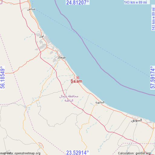
Şaḩam GPS coordinates[2]
24° 10' 19.992" North, 56° 53' 18.996" East
| Map corner | latitude | longitude |
|---|---|---|
| Upper-left | 24.81207°, | 56.18549° |
| Center: | 24.17222°, | 56.88861° |
| Lower-right: | 23.52914°, | 57.59174° |
| Map W x H: | 142.6×142.6 km | = 88.6×88.6mi |
| max Lat: | 26.19778° ⇑22.6% North |
| Şaḩam: | 24.17222° |
| min Lat: | ⇓77.4% South 17.01505° |
| min Long | Şaḩam | max Long |
| 52.66042° | 56.88861° | 59.52889° |
| W 38.7%⇐ | ⇒61.3% E |
Elevation
Elevation of Şaḩam is 2 m = 7 ft, and this is 204.7 m = 672 ft below average elevation for this country.
| Max E: |
684 m = 2244 ft | 96.8% |
| Avg. | 206.7 m = 678 ft | |
| Şaḩam | 2 m = 7 ft | |
Min E: |
1 m = 3 ft | 3.2% |
See also: Şaḩam elevation on elevation.city.
Geographical zone
Şaḩam is located in North temperate zone (between Tropic of Cancer and the Arctic Circle). Distance of this Northern Tropic circle is 81.8 km =50.8 mi to South.| Distance of | km | miles | from Şaḩam |
|---|---|---|---|
| North Pole | 7319.4 | 4548.1 | to North |
| Arctic Circle | 4713.5 | 2928.8 | to North |
| Tropic Cancer | 81.8 | 50.8 | to South |
| Equator | 2687.7 | 1670.1 | to South |


Nearby cities:
15 places around Şaḩam: (largest is in red/bold)
• Al Buraymī
111.4 km =69.2 mi,  274°
274°
• Al Khābūrah
30.5 km =19 mi,  137°
137°
• As Suwayq
66.4 km =41.3 mi,  122°
122°
• Bahlā’
139.3 km =86.6 mi,  162°
162°
• Barkā’
115.3 km =71.6 mi, 118°
• Bayt al ‘Awābī
116.3 km =72.3 mi,  146°
146°
• Liwá
51.7 km =32.1 mi,  320°
320°
• Madḩā’ al Jadīdah
135.7 km =84.3 mi,  335°
335°
• Oman Smart Future City
92.5 km =57.5 mi,  128°
128°
• Rustaq
102.6 km =63.8 mi, 147°
• Seeb
143.5 km =89.2 mi,  112°
112°
• Shināş
76.4 km =47.5 mi,  326°
326°
• Sohar
26.6 km =16.5 mi, 316°
• Yanqul
74.2 km =46.1 mi,  208°
208°
• ‘Ibrī
111.9 km =69.5 mi,  199°
199°
Sources, notices
• [Note1] Compared only with cities in Oman existing in our database
• [Src1] Map data: © OpenStreetMap contributors (CC-BY-SA)
• [Src2] Other city data from geonames.org with taken over terms of usage.
• [Src3] Geographical zone / Annual Mean Temperature by Robert A. Rohde @ Wikipedia
