Shināş geodata
Shināş (Al Batinah North) is a populated place; located in Oman in Asia/Muscat (GMT+4) time zone. With population of 48,009 people, there are 15 cities with bigger population in this country. Compared to other cities in Oman, 90.3% of cities are located further ↓South; 77.4% of cities are located further →East and 93.5% of cities have higher elevation than Shināş. Note1


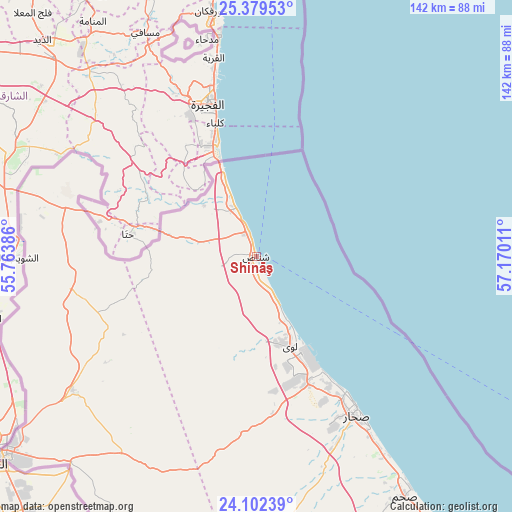
Shināş GPS coordinates[2]
24° 44' 33.36" North, 56° 28' 1.128" East
| Map corner | latitude | longitude |
|---|---|---|
| Upper-left | 25.37953°, | 55.76386° |
| Center: | 24.7426°, | 56.46698° |
| Lower-right: | 24.10239°, | 57.17011° |
| Map W x H: | 142×142 km | = 88.2×88.2mi |
| max Lat: | 26.19778° ⇑9.7% North |
| Shināş: | 24.7426° |
| min Lat: | ⇓90.3% South 17.01505° |
| min Long | Shināş | max Long |
| 52.66042° | 56.46698° | 59.52889° |
| W 22.6%⇐ | ⇒77.4% E |
Elevation
Elevation of Shināş is 3 m = 10 ft, and this is 203.7 m = 668 ft below average elevation for this country.
| Max E: |
684 m = 2244 ft | 93.5% |
| Avg. | 206.7 m = 678 ft | |
| Shināş | 3 m = 10 ft | |
Min E: |
1 m = 3 ft | 6.5% |
See also: Shināş elevation on elevation.city.
Geographical zone
Shināş is located in North temperate zone (between Tropic of Cancer and the Arctic Circle). Distance of this Northern Tropic circle is 145.2 km =90.2 mi to South.| Distance of | km | miles | from Shināş |
|---|---|---|---|
| North Pole | 7255.9 | 4508.6 | to North |
| Arctic Circle | 4650.1 | 2889.4 | to North |
| Tropic Cancer | 145.2 | 90.2 | to South |
| Equator | 2751.1 | 1709.5 | to South |


Nearby cities:
15 places around Shināş: (largest is in red/bold)
• Al Buraymī
87.4 km =54.3 mi,  231°
231°
• Al Khābūrah
106.7 km =66.3 mi,  143°
143°
• As Suwayq
139.8 km =86.9 mi, 135°
• Barkā’
186.3 km =115.8 mi,  129°
129°
• Bayt al ‘Awābī
192.7 km =119.7 mi,  146°
146°
• Dib Dibba
163.2 km =101.4 mi,  352°
352°
• Khasab
161.3 km =100.2 mi, 352°
• Liwá
25.5 km =15.8 mi,  157°
157°
• Madḩā’ al Jadīdah
61.6 km =38.3 mi, 347°
• Oman Smart Future City
167 km =103.8 mi, 136°
• Rustaq
179 km =111.2 mi, 147°
• Sohar
50.3 km =31.3 mi, 150°
• Yanqul
128.8 km =80 mi,  176°
176°
• Şaḩam
76.4 km =47.5 mi, 146°
• ‘Ibrī
168.7 km =104.8 mi, 178°
Sources, notices
• [Note1] Compared only with cities in Oman existing in our database
• [Src1] Map data: © OpenStreetMap contributors (CC-BY-SA)
• [Src2] Other city data from geonames.org with taken over terms of usage.
• [Src3] Geographical zone / Annual Mean Temperature by Robert A. Rohde @ Wikipedia
