La Ensenada geodata
La Ensenada (Panamá) is a seat of a third-order administrative division; located in Panama in America/Panama (GMT-5) time zone. With population of 94 people, there are 657 cities with bigger population in this country. Compared to other cities in Panama, 61.2% of cities are located further ↑North; 92.8% of cities are located further ←West and 84.5% of cities have higher elevation than La Ensenada. Note1


La Ensenada GPS coordinates[2]
8° 21' 58.248" North, 78° 50' 45.816" West
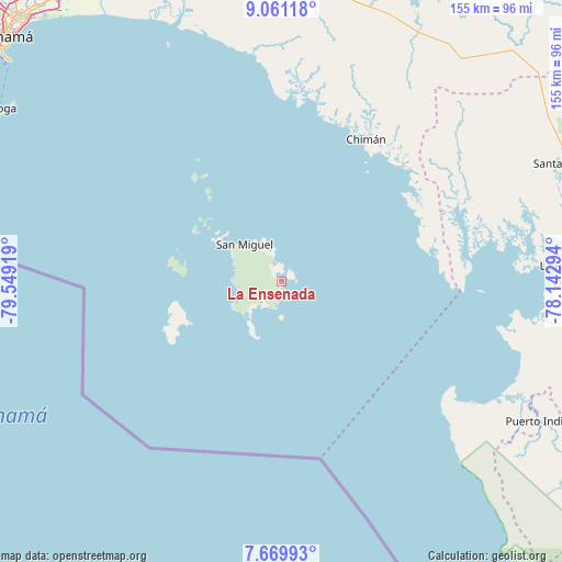
| Map corner | latitude | longitude |
|---|---|---|
| Upper-left | 9.06118°, | -79.54919° |
| Center: | 8.36618°, | -78.84606° |
| Lower-right: | 7.66993°, | -78.14294° |
| Map W x H: | 154.7×154.7 km | = 96.1×96.1mi |
| max Lat: | 9.60898° ⇑61.2% North |
| La Ensenada: | 8.36618° |
| min Lat: | ⇓38.8% South 7.26534° |
| min Long | La Ensenada | max Long |
| -82.91275° | -78.84606° | -77.38965° |
| W 92.8%⇐ | ⇒7.2% E |
Elevation
Elevation of La Ensenada is 18 m = 59 ft, and this is 154.1 m = 506 ft below average elevation for this country.
| Max E: |
2103 m = 6900 ft | 84.5% |
| Avg. | 172.1 m = 565 ft | |
| La Ensenada | 18 m = 59 ft | |
Min E: |
-1 m = -3 ft | 15.5% |
See also: Panama elevation on elevation.city.
Geographical zone
La Ensenada is located in North Torrid zone (between Equator and Tropic of Cancer). Distance of Equator is 930.2 km =578 mi to South.| Distance of | km | miles | from La Ensenada |
|---|---|---|---|
| North Pole | 9076.8 | 5640.1 | to North |
| Arctic Circle | 6470.9 | 4020.8 | to North |
| Tropic Cancer | 1675.7 | 1041.2 | to North |
| Equator | 930.2 | 578 | to South |


Nearby cities:
15 places around La Ensenada: (largest is in red/bold)
• Barriales
55.9 km =34.7 mi,  64°
64°
• Brujas
42.4 km =26.3 mi,  54°
54°
• Chimán
42.9 km =26.7 mi,  32°
32°
• Contadora
35.6 km =22.1 mi,  323°
323°
• Cucunatí
68.9 km =42.8 mi,  70°
70°
• Garachiné
62.6 km =38.9 mi,  122°
122°
• Gonzalo Vásquez
43.2 km =26.8 mi,  82°
82°
• La Esmeralda
13.9 km =8.6 mi,  218°
218°
• La Guinea
10.1 km =6.3 mi,  254°
254°
• Platanilla
72.2 km =44.9 mi,  44°
44°
• Pueblo Nuevo
69.8 km =43.4 mi,  110°
110°
• Punta Alegre
65.6 km =40.8 mi,  96°
96°
• Pásiga
63.8 km =39.6 mi,  353°
353°
• San Miguel
14.2 km =8.8 mi, 315°
• Unión Santeña
56.4 km =35 mi,  22°
22°
Sources, notices
• [Note1] Compared only with cities in Panama existing in our database
• [Src1] Map data: © OpenStreetMap contributors (CC-BY-SA)
• [Src2] Other city data from geonames.org with taken over terms of usage.
• [Src3] Geographical zone / Annual Mean Temperature by Robert A. Rohde @ Wikipedia
