La Yeguada geodata
La Yeguada (Veraguas) is a seat of a third-order administrative division; located in Panama in America/Panama (GMT-5) time zone. With population of 122 people, there are 645 cities with bigger population in this country. Compared to other cities in Panama, 54.8% of cities are located further ↑North; 58.2% of cities are located further →East and 93.6% of cities have lower elevation than La Yeguada. Note1


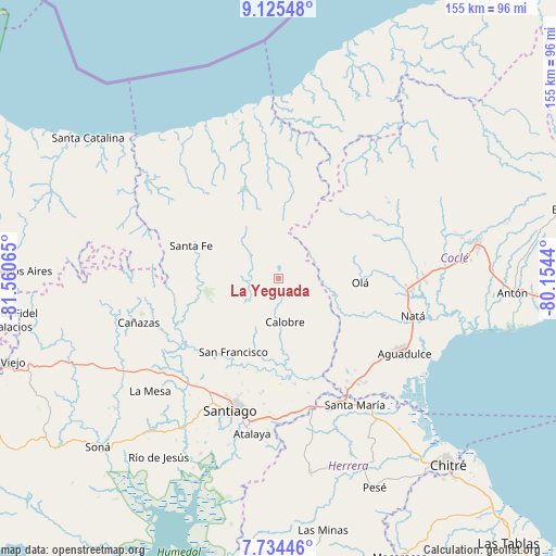
La Yeguada GPS coordinates[2]
8° 25' 50.16" North, 80° 51' 27.072" West
| Map corner | latitude | longitude |
|---|---|---|
| Upper-left | 9.12548°, | -81.56065° |
| Center: | 8.4306°, | -80.85752° |
| Lower-right: | 7.73446°, | -80.1544° |
| Map W x H: | 154.7×154.7 km | = 96.1×96.1mi |
| max Lat: | 9.60898° ⇑54.8% North |
| La Yeguada: | 8.4306° |
| min Lat: | ⇓45.2% South 7.26534° |
| min Long | La Yeguada | max Long |
| -82.91275° | -80.85752° | -77.38965° |
| W 41.8%⇐ | ⇒58.2% E |
Elevation
Elevation of La Yeguada is 578 m = 1896 ft, and this is 405.9 m = 1332 ft above average elevation for this country.
| Max E: |
2103 m = 6900 ft | 6.4% |
| La Yeguada | 578 m 1896 ft | |
| Avg. | 172.1 m = 565 ft | |
Min E: |
-1 m = -3 ft | 93.6% |
See also: Panama elevation on elevation.city.
Geographical zone
La Yeguada is located in North Torrid zone (between Equator and Tropic of Cancer). Distance of Equator is 937.4 km =582.5 mi to South.| Distance of | km | miles | from La Yeguada |
|---|---|---|---|
| North Pole | 9069.7 | 5635.6 | to North |
| Arctic Circle | 6463.8 | 4016.4 | to North |
| Tropic Cancer | 1668.5 | 1036.8 | to North |
| Equator | 937.4 | 582.5 | to South |


Nearby cities:
15 places around La Yeguada: (largest is in red/bold)
• Barnizal
9.2 km =5.7 mi,  108°
108°
• Boquerón
20.7 km =12.9 mi,  180°
180°
• Calobre
12.6 km =7.8 mi,  171°
171°
• El Alto
21.7 km =13.5 mi,  294°
294°
• El Coclá
14 km =8.7 mi,  209°
209°
• El Copé
19.6 km =12.2 mi,  87°
87°
• El Peñón
15.8 km =9.8 mi,  235°
235°
• El Potrero
9.2 km =5.7 mi,  130°
130°
• Gatú
15.7 km =9.8 mi,  319°
319°
• La Laguna
17.4 km =10.8 mi, 125°
• Las Huacas del Quije
12.4 km =7.7 mi,  70°
70°
• Monjarás
6.9 km =4.3 mi,  188°
188°
• Piedras Gordas
12 km =7.5 mi,  330°
330°
• San José
7 km =4.3 mi,  54°
54°
• San Juan
22.4 km =13.9 mi,  230°
230°
Sources, notices
• [Note1] Compared only with cities in Panama existing in our database
• [Src1] Map data: © OpenStreetMap contributors (CC-BY-SA)
• [Src2] Other city data from geonames.org with taken over terms of usage.
• [Src3] Geographical zone / Annual Mean Temperature by Robert A. Rohde @ Wikipedia
