Kankintú geodata
Kankintú (Ngöbe-Buglé) is a seat of a third-order administrative division; located in Panama in America/Panama (GMT-5) time zone. With population of 1,218 people, there are 201 cities with bigger population in this country. Compared to other cities in Panama, 76.2% of cities are located further ↓South; 75.4% of cities are located further →East and 54.4% of cities have lower elevation than Kankintú. Note1


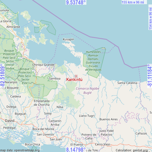
Kankintú GPS coordinates[2]
8° 50' 36.204" North, 81° 48' 53.856" West
| Map corner | latitude | longitude |
|---|---|---|
| Upper-left | 9.53748°, | -82.51809° |
| Center: | 8.84339°, | -81.81496° |
| Lower-right: | 8.14798°, | -81.11184° |
| Map W x H: | 154.5×154.5 km | = 96×96mi |
| max Lat: | 9.60898° ⇑23.8% North |
| Kankintú: | 8.84339° |
| min Lat: | ⇓76.2% South 7.26534° |
| min Long | Kankintú | max Long |
| -82.91275° | -81.81496° | -77.38965° |
| W 24.6%⇐ | ⇒75.4% E |
Elevation
Elevation of Kankintú is 85 m = 279 ft, and this is 87.1 m = 286 ft below average elevation for this country.
| Max E: |
2103 m = 6900 ft | 45.6% |
| Avg. | 172.1 m = 565 ft | |
| Kankintú | 85 m = 279 ft | |
Min E: |
-1 m = -3 ft | 54.4% |
See also: Panama elevation on elevation.city.
Geographical zone
Kankintú is located in North Torrid zone (between Equator and Tropic of Cancer). Distance of Equator is 983.3 km =611 mi to South.| Distance of | km | miles | from Kankintú |
|---|---|---|---|
| North Pole | 9023.8 | 5607.1 | to North |
| Arctic Circle | 6417.9 | 3987.9 | to North |
| Tropic Cancer | 1622.6 | 1008.2 | to North |
| Equator | 983.3 | 611 | to South |


Nearby cities:
15 places around Kankintú: (largest is in red/bold)
• Bahía Azul
34.3 km =21.3 mi,  345°
345°
• Bisira
7.2 km =4.5 mi,  323°
323°
• Boca del Río Chiriquí
26.6 km =16.5 mi,  89°
89°
• Cascabel
35.8 km =22.2 mi,  190°
190°
• Chiriquí Grande
35.1 km =21.8 mi,  288°
288°
• Cuoronte
19 km =11.8 mi,  170°
170°
• Hato Culantro
41.9 km =26 mi, 186°
• Kusapín
38 km =23.6 mi, 348°
• Mirones
33.3 km =20.7 mi,  162°
162°
• Nutiví
4.2 km =2.6 mi, 316°
• Piedra Roja
31.3 km =19.4 mi, 166°
• Punta Peña
41.4 km =25.7 mi,  281°
281°
• Quebrada Tula
19.9 km =12.4 mi,  269°
269°
• Rámbala
41.1 km =25.5 mi, 282°
• Tobobe
30.9 km =19.2 mi,  358°
358°
Sources, notices
• [Note1] Compared only with cities in Panama existing in our database
• [Src1] Map data: © OpenStreetMap contributors (CC-BY-SA)
• [Src2] Other city data from geonames.org with taken over terms of usage.
• [Src3] Geographical zone / Annual Mean Temperature by Robert A. Rohde @ Wikipedia
