Quebrada Tula geodata
Quebrada Tula (Ngöbe-Buglé) is a seat of a third-order administrative division; located in Panama in America/Panama (GMT-5) time zone. With population of 283 people, there are 563 cities with bigger population in this country. Compared to other cities in Panama, 75.6% of cities are located further ↓South; 78.7% of cities are located further →East and 72.4% of cities have higher elevation than Quebrada Tula. Note1


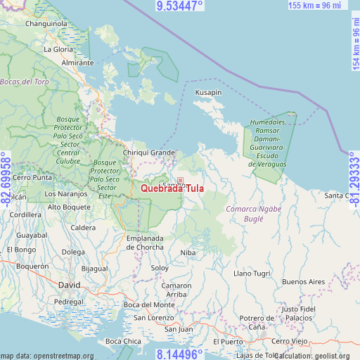
Quebrada Tula GPS coordinates[2]
8° 50' 25.332" North, 81° 59' 47.22" West
| Map corner | latitude | longitude |
|---|---|---|
| Upper-left | 9.53447°, | -82.69958° |
| Center: | 8.84037°, | -81.99645° |
| Lower-right: | 8.14496°, | -81.29333° |
| Map W x H: | 154.5×154.5 km | = 96×96mi |
| max Lat: | 9.60898° ⇑24.4% North |
| Quebrada Tula: | 8.84037° |
| min Lat: | ⇓75.6% South 7.26534° |
| min Long | Quebrada Tula | max Long |
| -82.91275° | -81.99645° | -77.38965° |
| W 21.3%⇐ | ⇒78.7% E |
Elevation
Elevation of Quebrada Tula is 33 m = 108 ft, and this is 139.1 m = 456 ft below average elevation for this country.
| Max E: |
2103 m = 6900 ft | 72.4% |
| Avg. | 172.1 m = 565 ft | |
| Quebrada Tula | 33 m = 108 ft | |
Min E: |
-1 m = -3 ft | 27.6% |
See also: Panama elevation on elevation.city.
Geographical zone
Quebrada Tula is located in North Torrid zone (between Equator and Tropic of Cancer). Distance of Equator is 983 km =610.8 mi to South.| Distance of | km | miles | from Quebrada Tula |
|---|---|---|---|
| North Pole | 9024.1 | 5607.3 | to North |
| Arctic Circle | 6418.2 | 3988.1 | to North |
| Tropic Cancer | 1623 | 1008.5 | to North |
| Equator | 983 | 610.8 | to South |


Nearby cities:
15 places around Quebrada Tula: (largest is in red/bold)
• Bahía Azul
35.3 km =21.9 mi,  18°
18°
• Bisira
16.9 km =10.5 mi,  68°
68°
• Boca de Balsa
34.7 km =21.6 mi,  186°
186°
• Cayo de Agua
35.1 km =21.8 mi,  349°
349°
• Chiriquí Grande
17.7 km =11 mi,  311°
311°
• Cuoronte
29.6 km =18.4 mi,  128°
128°
• Kankintú
19.9 km =12.4 mi,  89°
89°
• Los Chiricanos
28.4 km =17.6 mi,  302°
302°
• Miramar
31.9 km =19.8 mi, 302°
• Nutiví
17.4 km =10.8 mi,  78°
78°
• Pueblo Nuevo
25.4 km =15.8 mi,  280°
280°
• Punta Peña
22.4 km =13.9 mi,  292°
292°
• Punta Róbalo
35.3 km =21.9 mi, 308°
• Rámbala
22.1 km =13.7 mi, 293°
• Valle de La Mina
32.5 km =20.2 mi,  232°
232°
Sources, notices
• [Note1] Compared only with cities in Panama existing in our database
• [Src1] Map data: © OpenStreetMap contributors (CC-BY-SA)
• [Src2] Other city data from geonames.org with taken over terms of usage.
• [Src3] Geographical zone / Annual Mean Temperature by Robert A. Rohde @ Wikipedia
