Pueblo Nuevo geodata
Pueblo Nuevo (Ngöbe-Buglé) is a seat of a third-order administrative division; located in Panama in America/Panama (GMT-5) time zone. With population of 1,109 people, there are 223 cities with bigger population in this country. Compared to other cities in Panama, 78.6% of cities are located further ↓South; 81.2% of cities are located further →East and 68.1% of cities have lower elevation than Pueblo Nuevo. Note1


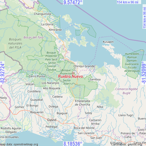
Pueblo Nuevo GPS coordinates[2]
8° 52' 50.52" North, 82° 13' 26.796" West
| Map corner | latitude | longitude |
|---|---|---|
| Upper-left | 9.57472°, | -82.92724° |
| Center: | 8.8807°, | -82.22411° |
| Lower-right: | 8.18536°, | -81.52099° |
| Map W x H: | 154.5×154.5 km | = 96×96mi |
| max Lat: | 9.60898° ⇑21.4% North |
| Pueblo Nuevo: | 8.8807° |
| min Lat: | ⇓78.6% South 7.26534° |
| min Long | Pueblo Nuevo | max Long |
| -82.91275° | -82.22411° | -77.38965° |
| W 18.8%⇐ | ⇒81.2% E |
Elevation
Elevation of Pueblo Nuevo is 141 m = 463 ft, and this is 31.1 m = 102 ft below average elevation for this country.
| Max E: |
2103 m = 6900 ft | 31.9% |
| Avg. | 172.1 m = 565 ft | |
| Pueblo Nuevo | 141 m = 463 ft | |
Min E: |
-1 m = -3 ft | 68.1% |
See also: Panama elevation on elevation.city.
Geographical zone
Pueblo Nuevo is located in North Torrid zone (between Equator and Tropic of Cancer). Distance of Equator is 987.4 km =613.5 mi to South.| Distance of | km | miles | from Pueblo Nuevo |
|---|---|---|---|
| North Pole | 9019.6 | 5604.5 | to North |
| Arctic Circle | 6413.7 | 3985.3 | to North |
| Tropic Cancer | 1618.5 | 1005.7 | to North |
| Equator | 987.4 | 613.5 | to South |


Nearby cities:
15 places around Pueblo Nuevo: (largest is in red/bold)
• Alto Lino
24.8 km =15.4 mi,  248°
248°
• Bajo Boquete
26 km =16.2 mi,  241°
241°
• Boquete
26.4 km =16.4 mi, 244°
• Chiriquí Grande
13.7 km =8.5 mi,  58°
58°
• Jaramillo Arriba
23.9 km =14.9 mi, 247°
• Los Chiricanos
10.9 km =6.8 mi,  5°
5°
• Los Naranjos
26.4 km =16.4 mi, 248°
• Miramar
12.8 km =8 mi,  351°
351°
• Norteño
16.9 km =10.5 mi,  323°
323°
• Paja de Sombrero
24.3 km =15.1 mi,  205°
205°
• Punta Peña
5.9 km =3.7 mi,  47°
47°
• Punta Róbalo
17.5 km =10.9 mi, 350°
• Quebrada Tula
25.4 km =15.8 mi,  100°
100°
• Rámbala
6.5 km =4 mi, 47°
• Valle de La Mina
24.1 km =15 mi,  182°
182°
Sources, notices
• [Note1] Compared only with cities in Panama existing in our database
• [Src1] Map data: © OpenStreetMap contributors (CC-BY-SA)
• [Src2] Other city data from geonames.org with taken over terms of usage.
• [Src3] Geographical zone / Annual Mean Temperature by Robert A. Rohde @ Wikipedia
