Las Palmas geodata
Las Palmas (Huanuco) is a seat of a third-order administrative division; located in Peru in America/Lima (GMT-5) time zone. In our database, there are 305 cities with bigger population. Compared to other cities in Peru, 65.5% of cities are located further ↓South; 52.9% of cities are located further →East and 72% of cities have higher elevation than Las Palmas. Note1
Administrative division(s):
- Level 1: Huanuco
- Level 2: Provincia de Leoncio Prado
- Level 3: Mariano Damaso Beraun


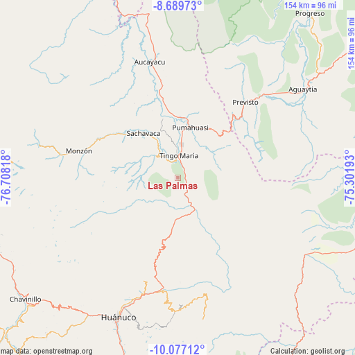
Las Palmas GPS coordinates[2]
9° 23' 2.832" South, 76° 0' 18.18" West
| Map corner | latitude | longitude |
|---|---|---|
| Upper-left | -8.68973°, | -76.70818° |
| Center: | -9.38412°, | -76.00505° |
| Lower-right: | -10.07712°, | -75.30193° |
| Map W x H: | 154.3×154.3 km | = 95.9×95.9mi |
| max Lat: | -0.96667° ⇑34.5% North |
| Las Palmas: | -9.38412° |
| min Lat: | ⇓65.5% South -18.01465° |
| min Long | Las Palmas | max Long |
| -81.30472° | -76.00505° | -69.04167° |
| W 47.1%⇐ | ⇒52.9% E |
Elevation
Elevation of Las Palmas is 1092 m = 3583 ft, and this is 1226.7 m = 4025 ft below average elevation for this country.
| Max E: |
5022 m = 16476 ft | 72% |
| Avg. | 2318.7 m = 7607 ft | |
| Las Palmas | 1092 m = 3583 ft | |
Min E: |
1 m = 3 ft | 28% |
See also: Peru elevation on elevation.city.
Geographical zone
Las Palmas is located in South Torrid zone (between Equator and Tropic of Capricorn). Distance of Equator is 1043.4 km =648.3 mi to North.| Distance of | km | miles | from Las Palmas |
|---|---|---|---|
| Equator | 1043.4 | 648.3 | to North |
| Tropic Capricorn | 1562.5 | 970.9 | to South |
| Antarctic Circle | 6357.8 | 3950.6 | to South |
| South Pole | 8963.6 | 5569.7 | to South |


Nearby cities:
15 places around Las Palmas: (largest is in red/bold)
• Acomayo
46.9 km =29.1 mi,  188°
188°
• Aucayacu
51.7 km =32.1 mi,  346°
346°
• Cayhuayna
69.2 km =43 mi,  202°
202°
• Chaglla
52.3 km =32.5 mi,  167°
167°
• Churubamba
51.1 km =31.8 mi, 195°
• Conchamarca
76.2 km =47.3 mi, 197°
• Huancapallac
72.3 km =44.9 mi,  218°
218°
• Huánuco
66.1 km =41.1 mi, 203°
• Jacas Grande
82.1 km =51 mi,  257°
257°
• Panao
57.1 km =35.5 mi,  178°
178°
• Paucarbamba
66.7 km =41.4 mi, 200°
• Quivilla
82.5 km =51.3 mi,  253°
253°
• Tantamayo
78.8 km =49 mi,  269°
269°
• Tingo María
9.9 km =6.2 mi,  5°
5°
• Tomay Kichwa
80.3 km =49.9 mi, 196°
Sources, notices
• [Note1] Compared only with cities in Peru existing in our database
• [Src1] Map data: © OpenStreetMap contributors (CC-BY-SA)
• [Src2] Other city data from geonames.org with taken over terms of usage.
• [Src3] Geographical zone / Annual Mean Temperature by Robert A. Rohde @ Wikipedia
