San Pedro de Lloc geodata
San Pedro de Lloc (La Libertad) is a populated place; located in Peru in America/Lima (GMT-5) time zone. With population of 16,250 people, there are 95 cities with bigger population in this country. Compared to other cities in Peru, 76.5% of cities are located further ↓South; 93.3% of cities are located further →East and 93% of cities have higher elevation than San Pedro de Lloc. Note1
Administrative division(s):
- Level 1: La Libertad
- Level 2: Provincia de Pacasmayo
- Level 3: San Pedro De Lloc


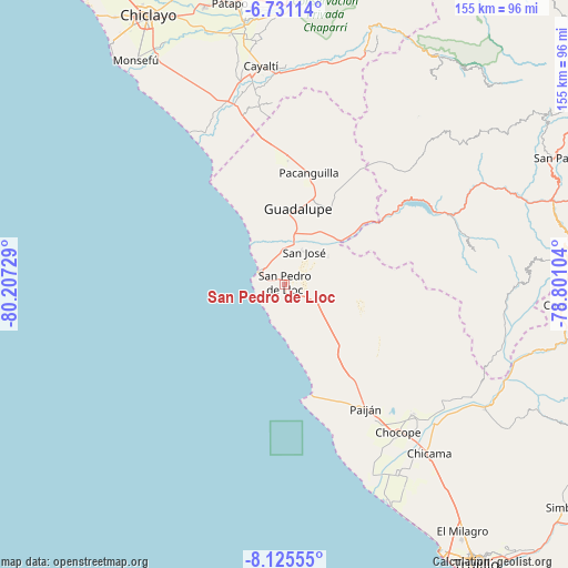
San Pedro de Lloc GPS coordinates[2]
7° 25' 44.04" South, 79° 30' 14.976" West
| Map corner | latitude | longitude |
|---|---|---|
| Upper-left | -6.73114°, | -80.20729° |
| Center: | -7.4289°, | -79.50416° |
| Lower-right: | -8.12555°, | -78.80104° |
| Map W x H: | 155×155 km | = 96.3×96.3mi |
| max Lat: | -0.96667° ⇑23.5% North |
| San Pedro de Lloc: | -7.4289° |
| min Lat: | ⇓76.5% South -18.01465° |
| min Long | San Pedro de Ll | max Long |
| -81.30472° | -79.50416° | -69.04167° |
| W 6.7%⇐ | ⇒93.3% E |
Elevation
Elevation of San Pedro de Lloc is 48 m = 157 ft, and this is 2270.7 m = 7450 ft below average elevation for this country.
| Max E: |
5022 m = 16476 ft | 93% |
| Avg. | 2318.7 m = 7607 ft | |
| San Pedro de Lloc | 48 m = 157 ft | |
Min E: |
1 m = 3 ft | 7% |
See also: Peru elevation on elevation.city.
Geographical zone
San Pedro de Lloc is located in South Torrid zone (between Equator and Tropic of Capricorn). Distance of Equator is 826 km =513.3 mi to North.| Distance of | km | miles | from San Pedro de Lloc |
|---|---|---|---|
| Equator | 826 | 513.3 | to North |
| Tropic Capricorn | 1779.9 | 1106 | to South |
| Antarctic Circle | 6575.2 | 4085.6 | to South |
| South Pole | 9181 | 5704.8 | to South |


Nearby cities:
15 places around San Pedro de Lloc: (largest is in red/bold)
• Ascope
54 km =33.6 mi,  126°
126°
• Casa Grande
49.5 km =30.8 mi,  135°
135°
• Chepén
24.4 km =15.2 mi,  21°
21°
• Chicama
60.7 km =37.7 mi, 139°
• Chocope
50.9 km =31.6 mi, 142°
• Guadalupe
20 km =12.4 mi,  6°
6°
• Mocupe
50.5 km =31.4 mi,  345°
345°
• Nanchoc
59.6 km =37 mi,  28°
28°
• Pacanga
29.2 km =18.1 mi,  0°
0°
• Pacasmayo
8.1 km =5 mi,  293°
293°
• Paiján
40.5 km =25.2 mi,  146°
146°
• Pueblo Nuevo
26.8 km =16.7 mi,  357°
357°
• Saña
57.4 km =35.7 mi, 351°
• Tembladera
43 km =26.7 mi,  65°
65°
• Trinidad
52.7 km =32.7 mi,  80°
80°
Sources, notices
• [Note1] Compared only with cities in Peru existing in our database
• [Src1] Map data: © OpenStreetMap contributors (CC-BY-SA)
• [Src2] Other city data from geonames.org with taken over terms of usage.
• [Src3] Geographical zone / Annual Mean Temperature by Robert A. Rohde @ Wikipedia
