Nanchoc geodata
Nanchoc (Cajamarca) is a seat of a third-order administrative division; located in Peru in America/Lima (GMT-5) time zone. In our database, there are 305 cities with bigger population. Compared to other cities in Peru, 79.7% of cities are located further ↓South; 91.9% of cities are located further →East and 79.4% of cities have higher elevation than Nanchoc. Note1


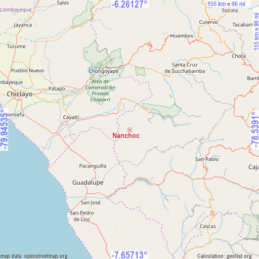
Nanchoc GPS coordinates[2]
6° 57' 34.992" South, 79° 14' 31.992" West
| Map corner | latitude | longitude |
|---|---|---|
| Upper-left | -6.26127°, | -79.94535° |
| Center: | -6.95972°, | -79.24222° |
| Lower-right: | -7.65713°, | -78.5391° |
| Map W x H: | 155.2×155.2 km | = 96.4×96.4mi |
| max Lat: | -0.96667° ⇑20.3% North |
| Nanchoc: | -6.95972° |
| min Lat: | ⇓79.7% South -18.01465° |
| min Long | Nanchoc | max Long |
| -81.30472° | -79.24222° | -69.04167° |
| W 8.1%⇐ | ⇒91.9% E |
Elevation
Elevation of Nanchoc is 395 m = 1296 ft, and this is 1923.7 m = 6311 ft below average elevation for this country.
| Max E: |
5022 m = 16476 ft | 79.4% |
| Avg. | 2318.7 m = 7607 ft | |
| Nanchoc | 395 m = 1296 ft | |
Min E: |
1 m = 3 ft | 20.6% |
See also: Peru elevation on elevation.city.
Geographical zone
Nanchoc is located in South Torrid zone (between Equator and Tropic of Capricorn). Distance of Equator is 773.8 km =480.8 mi to North.| Distance of | km | miles | from Nanchoc |
|---|---|---|---|
| Equator | 773.8 | 480.8 | to North |
| Tropic Capricorn | 1832.1 | 1138.4 | to South |
| Antarctic Circle | 6627.3 | 4118 | to South |
| South Pole | 9233.2 | 5737.2 | to South |


Nearby cities:
15 places around Nanchoc: (largest is in red/bold)
• Catache
39.2 km =24.4 mi,  36°
36°
• Chepén
35.7 km =22.2 mi,  214°
214°
• Chongoyape
39 km =24.2 mi,  335°
335°
• El Prado
28 km =17.4 mi,  107°
107°
• Guadalupe
41.8 km =26 mi,  219°
219°
• La Florida
16.7 km =10.4 mi,  53°
53°
• Mocupe
41.7 km =25.9 mi,  265°
265°
• Niepos
13.1 km =8.1 mi,  73°
73°
• Nueva Arica
14.7 km =9.1 mi,  311°
311°
• Oyotún
14.4 km =8.9 mi,  333°
333°
• Pacanga
36.6 km =22.7 mi,  231°
231°
• Pueblo Nuevo
39.4 km =24.5 mi, 229°
• San Gregorio
18.6 km =11.6 mi,  122°
122°
• Saña
37.8 km =23.5 mi,  276°
276°
• Tembladera
35.6 km =22.1 mi,  163°
163°
Sources, notices
• [Note1] Compared only with cities in Peru existing in our database
• [Src1] Map data: © OpenStreetMap contributors (CC-BY-SA)
• [Src2] Other city data from geonames.org with taken over terms of usage.
• [Src3] Geographical zone / Annual Mean Temperature by Robert A. Rohde @ Wikipedia
