Guadalupe geodata
Guadalupe (La Libertad) is a seat of a third-order administrative division; located in Peru in America/Lima (GMT-5) time zone. With population of 25,376 people, there are 71 cities with bigger population in this country. Compared to other cities in Peru, 77.2% of cities are located further ↓South; 93.2% of cities are located further →East and 90.4% of cities have higher elevation than Guadalupe. Note1


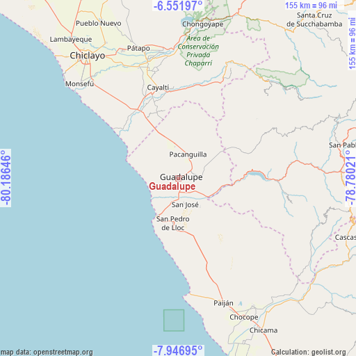
Guadalupe GPS coordinates[2]
7° 15' 0" South, 79° 28' 59.988" West
| Map corner | latitude | longitude |
|---|---|---|
| Upper-left | -6.55197°, | -80.18646° |
| Center: | -7.25°, | -79.48333° |
| Lower-right: | -7.94695°, | -78.78021° |
| Map W x H: | 155.1×155.1 km | = 96.4×96.4mi |
| max Lat: | -0.96667° ⇑22.8% North |
| Guadalupe: | -7.25° |
| min Lat: | ⇓77.2% South -18.01465° |
| min Long | Guadalupe | max Long |
| -81.30472° | -79.48333° | -69.04167° |
| W 6.8%⇐ | ⇒93.2% E |
Elevation
Elevation of Guadalupe is 83 m = 272 ft, and this is 2235.7 m = 7335 ft below average elevation for this country.
| Max E: |
5022 m = 16476 ft | 90.4% |
| Avg. | 2318.7 m = 7607 ft | |
| Guadalupe | 83 m = 272 ft | |
Min E: |
1 m = 3 ft | 9.6% |
See also: Peru elevation on elevation.city.
Geographical zone
Guadalupe is located in South Torrid zone (between Equator and Tropic of Capricorn). Distance of Equator is 806.1 km =500.9 mi to North.| Distance of | km | miles | from Guadalupe |
|---|---|---|---|
| Equator | 806.1 | 500.9 | to North |
| Tropic Capricorn | 1799.8 | 1118.3 | to South |
| Antarctic Circle | 6595 | 4097.9 | to South |
| South Pole | 9200.9 | 5717.2 | to South |


Nearby cities:
15 places around Guadalupe: (largest is in red/bold)
• Chepén
7.1 km =4.4 mi,  66°
66°
• Mocupe
32.6 km =20.3 mi,  332°
332°
• Nanchoc
41.8 km =26 mi,  39°
39°
• Niepos
53.1 km =33 mi,  47°
47°
• Nueva Arica
44.7 km =27.8 mi,  20°
20°
• Oyotún
49.4 km =30.7 mi, 24°
• Pacanga
9.4 km =5.8 mi,  348°
348°
• Pacasmayo
19.4 km =12.1 mi,  210°
210°
• Pueblo Nuevo
7.7 km =4.8 mi, 332°
• Reque
56.5 km =35.1 mi,  319°
319°
• San Gregorio
47.8 km =29.7 mi,  62°
62°
• San Pedro de Lloc
20 km =12.4 mi,  186°
186°
• Saña
38.4 km =23.9 mi,  343°
343°
• Tembladera
36.8 km =22.9 mi,  92°
92°
• Trinidad
50.9 km =31.6 mi,  102°
102°
Sources, notices
• [Note1] Compared only with cities in Peru existing in our database
• [Src1] Map data: © OpenStreetMap contributors (CC-BY-SA)
• [Src2] Other city data from geonames.org with taken over terms of usage.
• [Src3] Geographical zone / Annual Mean Temperature by Robert A. Rohde @ Wikipedia
