Pampa Hermosa geodata
Pampa Hermosa (Loreto) is a seat of a third-order administrative division; located in Peru in America/Lima (GMT-5) time zone. In our database, there are 305 cities with bigger population. Compared to other cities in Peru, 77.6% of cities are located further ↓South; 55.3% of cities are located further ←West and 87.8% of cities have higher elevation than Pampa Hermosa. Note1


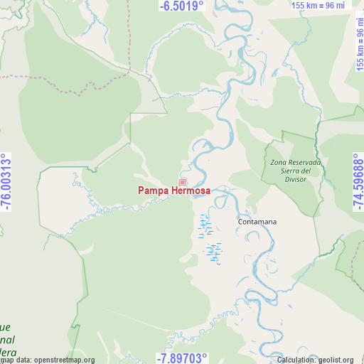
Pampa Hermosa GPS coordinates[2]
7° 12' 0" South, 75° 18' 0" West
| Map corner | latitude | longitude |
|---|---|---|
| Upper-left | -6.5019°, | -76.00313° |
| Center: | -7.2°, | -75.3° |
| Lower-right: | -7.89703°, | -74.59688° |
| Map W x H: | 155.1×155.1 km | = 96.4×96.4mi |
| max Lat: | -0.96667° ⇑22.4% North |
| Pampa Hermosa: | -7.2° |
| min Lat: | ⇓77.6% South -18.01465° |
| min Long | Pampa Hermosa | max Long |
| -81.30472° | -75.3° | -69.04167° |
| W 55.3%⇐ | ⇒44.7% E |
Elevation
Elevation of Pampa Hermosa is 132 m = 433 ft, and this is 2186.7 m = 7174 ft below average elevation for this country.
| Max E: |
5022 m = 16476 ft | 87.8% |
| Avg. | 2318.7 m = 7607 ft | |
| Pampa Hermosa | 132 m = 433 ft | |
Min E: |
1 m = 3 ft | 12.2% |
See also: Peru elevation on elevation.city.
Geographical zone
Pampa Hermosa is located in South Torrid zone (between Equator and Tropic of Capricorn). Distance of Equator is 800.6 km =497.5 mi to North.| Distance of | km | miles | from Pampa Hermosa |
|---|---|---|---|
| Equator | 800.6 | 497.5 | to North |
| Tropic Capricorn | 1805.4 | 1121.8 | to South |
| Antarctic Circle | 6600.6 | 4101.4 | to South |
| South Pole | 9206.5 | 5720.7 | to South |


Nearby cities:
15 places around Pampa Hermosa: (largest is in red/bold)
• Buenos Aires
122.1 km =75.9 mi,  291°
291°
• Chazuta
115.9 km =72 mi,  307°
307°
• Contamana
34.6 km =21.5 mi,  115°
115°
• Inahuaya
5.9 km =3.7 mi,  18°
18°
• Navarro
108.4 km =67.4 mi,  332°
332°
• Orellana
36.5 km =22.7 mi, 23°
• Pelejo
123.3 km =76.6 mi, 332°
• Picota
118 km =73.3 mi, 285°
• Pilluana
119 km =73.9 mi, 293°
• Pucacaca
121.3 km =75.4 mi, 288°
• Puerto Rico
125.6 km =78 mi,  280°
280°
• Sauce
115.7 km =71.9 mi,  299°
299°
• Shamboyacu
94 km =58.4 mi, 282°
• Tres Unidos
111.5 km =69.3 mi, 293°
• Utcurarca
124.2 km =77.2 mi, 298°
Sources, notices
• [Note1] Compared only with cities in Peru existing in our database
• [Src1] Map data: © OpenStreetMap contributors (CC-BY-SA)
• [Src2] Other city data from geonames.org with taken over terms of usage.
• [Src3] Geographical zone / Annual Mean Temperature by Robert A. Rohde @ Wikipedia
