Contamana geodata
Contamana (Loreto) is a seat of a third-order administrative division; located in Peru in America/Lima (GMT-5) time zone. With population of 13,885 people, there are 117 cities with bigger population in this country. Compared to other cities in Peru, 76.9% of cities are located further ↓South; 58.7% of cities are located further ←West and 87% of cities have higher elevation than Contamana. Note1


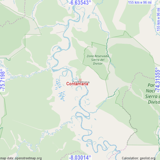
Contamana GPS coordinates[2]
7° 19' 59.988" South, 75° 1' 0.012" West
| Map corner | latitude | longitude |
|---|---|---|
| Upper-left | -6.63543°, | -75.7198° |
| Center: | -7.33333°, | -75.01667° |
| Lower-right: | -8.03014°, | -74.31355° |
| Map W x H: | 155.1×155.1 km | = 96.4×96.4mi |
| max Lat: | -0.96667° ⇑23.1% North |
| Contamana: | -7.33333° |
| min Lat: | ⇓76.9% South -18.01465° |
| min Long | Contamana | max Long |
| -81.30472° | -75.01667° | -69.04167° |
| W 58.7%⇐ | ⇒41.3% E |
Elevation
Elevation of Contamana is 147 m = 482 ft, and this is 2171.7 m = 7125 ft below average elevation for this country.
| Max E: |
5022 m = 16476 ft | 87% |
| Avg. | 2318.7 m = 7607 ft | |
| Contamana | 147 m = 482 ft | |
Min E: |
1 m = 3 ft | 13% |
See also: Peru elevation on elevation.city.
Geographical zone
Contamana is located in South Torrid zone (between Equator and Tropic of Capricorn). Distance of Equator is 815.4 km =506.7 mi to North.| Distance of | km | miles | from Contamana |
|---|---|---|---|
| Equator | 815.4 | 506.7 | to North |
| Tropic Capricorn | 1790.5 | 1112.6 | to South |
| Antarctic Circle | 6585.8 | 4092.2 | to South |
| South Pole | 9191.7 | 5711.5 | to South |


Nearby cities:
15 places around Contamana: (largest is in red/bold)
• Campoverde
129.1 km =80.2 mi,  169°
169°
• Chazuta
150 km =93.2 mi,  304°
304°
• Inahuaya
35.8 km =22.2 mi, 304°
• Navarro
137.5 km =85.4 mi,  323°
323°
• Nueva Requena
110.1 km =68.4 mi, 171°
• Orellana
50.9 km =31.6 mi,  341°
341°
• Pampa Hermosa
34.6 km =21.5 mi, 295°
• Pelejo
152.4 km =94.7 mi, 324°
• Picota
152.2 km =94.6 mi,  287°
287°
• Pilluana
153.6 km =95.4 mi, 293°
• Pucallpa
127 km =78.9 mi,  156°
156°
• Puerto Callao
124 km =77.1 mi, 156°
• Sauce
150.3 km =93.4 mi, 298°
• Shamboyacu
127.9 km =79.5 mi, 285°
• Tres Unidos
146.1 km =90.8 mi, 293°
Sources, notices
• [Note1] Compared only with cities in Peru existing in our database
• [Src1] Map data: © OpenStreetMap contributors (CC-BY-SA)
• [Src2] Other city data from geonames.org with taken over terms of usage.
• [Src3] Geographical zone / Annual Mean Temperature by Robert A. Rohde @ Wikipedia
