Chontabamba geodata
Chontabamba (Pasco) is a seat of a third-order administrative division; located in Peru in America/Lima (GMT-5) time zone. In our database, there are 305 cities with bigger population. Compared to other cities in Peru, 57.3% of cities are located further ↓South; 52.7% of cities are located further ←West and 61.4% of cities have higher elevation than Chontabamba. Note1


Chontabamba GPS coordinates[2]
10° 34' 59.988" South, 75° 28' 59.988" West
| Map corner | latitude | longitude |
|---|---|---|
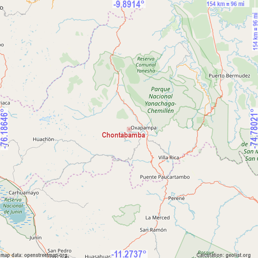
| Upper-left | -9.8914°, | -76.18646° |
| Center: | -10.58333°, | -75.48333° |
| Lower-right: | -11.2737°, | -74.78021° |
| Map W x H: | 153.7×153.7 km | = 95.5×95.5mi |
| max Lat: | -0.96667° ⇑42.7% North |
| Chontabamba: | -10.58333° |
| min Lat: | ⇓57.3% South -18.01465° |
| min Long | Chontabamba | max Long |
| -81.30472° | -75.48333° | -69.04167° |
| W 52.7%⇐ | ⇒47.3% E |
Elevation
Elevation of Chontabamba is 2359 m = 7740 ft, and this is 40.3 m = 132 ft above average elevation for this country.
| Max E: |
5022 m = 16476 ft | 61.4% |
| Chontabamba | 2359 m 7740 ft | |
| Avg. | 2318.7 m = 7607 ft | |
Min E: |
1 m = 3 ft | 38.6% |
See also: Peru elevation on elevation.city.
Geographical zone
Chontabamba is located in South Torrid zone (between Equator and Tropic of Capricorn). Distance of Equator is 1176.8 km =731.2 mi to North.| Distance of | km | miles | from Chontabamba |
|---|---|---|---|
| Equator | 1176.8 | 731.2 | to North |
| Tropic Capricorn | 1429.2 | 888.1 | to South |
| Antarctic Circle | 6224.4 | 3867.7 | to South |
| South Pole | 8830.3 | 5486.9 | to South |


Nearby cities:
15 places around Chontabamba: (largest is in red/bold)
• Bajo Pichanaqui
76.8 km =47.7 mi,  119°
119°
• Carhuamayo
70.6 km =43.9 mi,  238°
238°
• Huancabamba
26.5 km =16.5 mi,  348°
348°
• Huariaca
78.9 km =49 mi,  281°
281°
• Huasahuasi
77.9 km =48.4 mi,  193°
193°
• La Merced
55.6 km =34.5 mi,  163°
163°
• Ninacaca
75.3 km =46.8 mi,  246°
246°
• Oxapampa
8.9 km =5.5 mi,  85°
85°
• Pallanchacra
84.3 km =52.4 mi, 282°
• Paucartambo
41.6 km =25.8 mi, 239°
• Perené
49.2 km =30.6 mi,  144°
144°
• Pozuzo
57.7 km =35.9 mi, 354°
• San Rafael
81.3 km =50.5 mi,  289°
289°
• San Ramón
61.7 km =38.3 mi,  167°
167°
• Villa Rica
29.1 km =18.1 mi,  126°
126°
Sources, notices
• [Note1] Compared only with cities in Peru existing in our database
• [Src1] Map data: © OpenStreetMap contributors (CC-BY-SA)
• [Src2] Other city data from geonames.org with taken over terms of usage.
• [Src3] Geographical zone / Annual Mean Temperature by Robert A. Rohde @ Wikipedia
