Huancabamba geodata
Huancabamba (Pasco) is a seat of a third-order administrative division; located in Peru in America/Lima (GMT-5) time zone. In our database, there are 305 cities with bigger population. Compared to other cities in Peru, 58.7% of cities are located further ↓South; 52% of cities are located further ←West and 65.7% of cities have higher elevation than Huancabamba. Note1


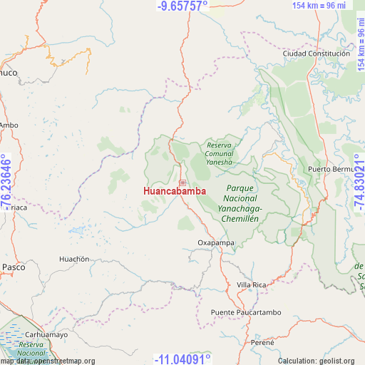
Huancabamba GPS coordinates[2]
10° 21' 0" South, 75° 31' 59.988" West
| Map corner | latitude | longitude |
|---|---|---|
| Upper-left | -9.65757°, | -76.23646° |
| Center: | -10.35°, | -75.53333° |
| Lower-right: | -11.04091°, | -74.83021° |
| Map W x H: | 153.8×153.8 km | = 95.6×95.6mi |
| max Lat: | -0.96667° ⇑41.3% North |
| Huancabamba: | -10.35° |
| min Lat: | ⇓58.7% South -18.01465° |
| min Long | Huancabamba | max Long |
| -81.30472° | -75.53333° | -69.04167° |
| W 52%⇐ | ⇒48% E |
Elevation
Elevation of Huancabamba is 1965 m = 6447 ft, and this is 353.7 m = 1160 ft below average elevation for this country.
| Max E: |
5022 m = 16476 ft | 65.7% |
| Avg. | 2318.7 m = 7607 ft | |
| Huancabamba | 1965 m = 6447 ft | |
Min E: |
1 m = 3 ft | 34.3% |
See also: Peru elevation on elevation.city.
Geographical zone
Huancabamba is located in South Torrid zone (between Equator and Tropic of Capricorn). Distance of Equator is 1150.8 km =715.1 mi to North.| Distance of | km | miles | from Huancabamba |
|---|---|---|---|
| Equator | 1150.8 | 715.1 | to North |
| Tropic Capricorn | 1455.1 | 904.2 | to South |
| Antarctic Circle | 6250.4 | 3883.8 | to South |
| South Pole | 8856.2 | 5503 | to South |


Nearby cities:
15 places around Huancabamba: (largest is in red/bold)
• Ambo
77.4 km =48.1 mi,  288°
288°
• Chaglla
69.3 km =43.1 mi,  324°
324°
• Chontabamba
26.5 km =16.5 mi,  168°
168°
• Huacar
79.8 km =49.6 mi, 285°
• Huariaca
72.6 km =45.1 mi,  261°
261°
• La Merced
82 km =51 mi,  164°
164°
• Oxapampa
29.1 km =18.1 mi,  150°
150°
• Pallanchacra
77.1 km =47.9 mi, 264°
• Panao
71.2 km =44.2 mi,  314°
314°
• Paucartambo
56 km =34.8 mi,  212°
212°
• Perené
74.3 km =46.2 mi, 152°
• Pozuzo
31.5 km =19.6 mi,  0°
0°
• San Rafael
71.1 km =44.2 mi,  271°
271°
• Tomay Kichwa
80.2 km =49.8 mi, 292°
• Villa Rica
52 km =32.3 mi, 146°
Sources, notices
• [Note1] Compared only with cities in Peru existing in our database
• [Src1] Map data: © OpenStreetMap contributors (CC-BY-SA)
• [Src2] Other city data from geonames.org with taken over terms of usage.
• [Src3] Geographical zone / Annual Mean Temperature by Robert A. Rohde @ Wikipedia
