Villa Rica geodata
Villa Rica (Pasco) is a seat of a third-order administrative division; located in Peru in America/Lima (GMT-5) time zone. With population of 7,448 people, there are 178 cities with bigger population in this country. Compared to other cities in Peru, 56.8% of cities are located further ↓South; 55.8% of cities are located further ←West and 69.7% of cities have higher elevation than Villa Rica. Note1


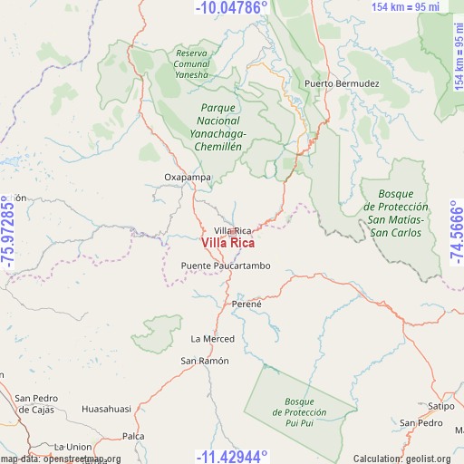
Villa Rica GPS coordinates[2]
10° 44' 21.984" South, 75° 16' 10.992" West
| Map corner | latitude | longitude |
|---|---|---|
| Upper-left | -10.04786°, | -75.97285° |
| Center: | -10.73944°, | -75.26972° |
| Lower-right: | -11.42944°, | -74.5666° |
| Map W x H: | 153.6×153.6 km | = 95.4×95.4mi |
| max Lat: | -0.96667° ⇑43.2% North |
| Villa Rica: | -10.73944° |
| min Lat: | ⇓56.8% South -18.01465° |
| min Long | Villa Rica | max Long |
| -81.30472° | -75.26972° | -69.04167° |
| W 55.8%⇐ | ⇒44.2% E |
Elevation
Elevation of Villa Rica is 1481 m = 4859 ft, and this is 837.7 m = 2748 ft below average elevation for this country.
| Max E: |
5022 m = 16476 ft | 69.7% |
| Avg. | 2318.7 m = 7607 ft | |
| Villa Rica | 1481 m = 4859 ft | |
Min E: |
1 m = 3 ft | 30.3% |
See also: Peru elevation on elevation.city.
Geographical zone
Villa Rica is located in South Torrid zone (between Equator and Tropic of Capricorn). Distance of Equator is 1194.1 km =742 mi to North.| Distance of | km | miles | from Villa Rica |
|---|---|---|---|
| Equator | 1194.1 | 742 | to North |
| Tropic Capricorn | 1411.8 | 877.3 | to South |
| Antarctic Circle | 6207.1 | 3856.9 | to South |
| South Pole | 8812.9 | 5476.1 | to South |


Nearby cities:
15 places around Villa Rica: (largest is in red/bold)
• Acobamba
80.5 km =50 mi,  212°
212°
• Bajo Pichanaqui
48 km =29.8 mi,  115°
115°
• Carhuamayo
85.7 km =53.3 mi,  256°
256°
• Chontabamba
29.1 km =18.1 mi,  306°
306°
• Huancabamba
52 km =32.3 mi,  326°
326°
• Huasahuasi
71.5 km =44.4 mi,  215°
215°
• La Merced
36.5 km =22.7 mi,  191°
191°
• Oxapampa
23.1 km =14.4 mi,  321°
321°
• Palca
74.9 km =46.5 mi, 205°
• Palcamayo
82.7 km =51.4 mi, 221°
• Paucartambo
59.3 km =36.8 mi,  266°
266°
• Perené
23.4 km =14.5 mi,  167°
167°
• Pozuzo
80.2 km =49.8 mi,  338°
338°
• San Ramón
43.8 km =27.2 mi, 192°
• Tapo
79.2 km =49.2 mi,  203°
203°
Sources, notices
• [Note1] Compared only with cities in Peru existing in our database
• [Src1] Map data: © OpenStreetMap contributors (CC-BY-SA)
• [Src2] Other city data from geonames.org with taken over terms of usage.
• [Src3] Geographical zone / Annual Mean Temperature by Robert A. Rohde @ Wikipedia
