Topdac geodata
Topdac (Cordillera) is a populated place; located in Philippines in Asia/Manila (GMT+8) time zone. With population of 2,288 people, there are 3708 cities with bigger population in this country. Compared to other cities in Philippines, 91.2% of cities are located further ↓South; 84.6% of cities are located further →East and 99.8% of cities have lower elevation than Topdac. Note1


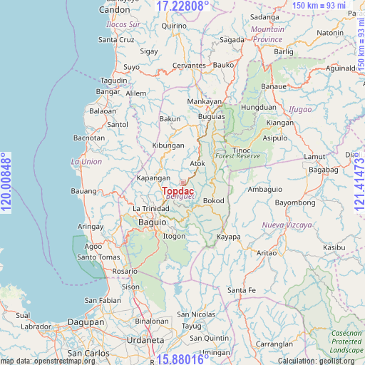
Topdac GPS coordinates[2]
16° 33' 19.08" North, 120° 42' 41.76" East
| Map corner | latitude | longitude |
|---|---|---|
| Upper-left | 17.22808°, | 120.00848° |
| Center: | 16.5553°, | 120.7116° |
| Lower-right: | 15.88016°, | 121.41473° |
| Map W x H: | 149.9×149.9 km | = 93.1×93.1mi |
| max Lat: | 20.78733° ⇑8.8% North |
| Topdac: | 16.5553° |
| min Lat: | ⇓91.2% South 4.65442° |
| min Long | Topdac | max Long |
| 117.04868° | 120.7116° | 126.58417° |
| W 15.4%⇐ | ⇒84.6% E |
Elevation
Elevation of Topdac is 1573 m = 5161 ft, and this is 1485.1 m = 4872 ft above average elevation for this country.
| Max E: |
2262 m = 7421 ft | 0.2% |
| Topdac | 1573 m 5161 ft | |
| Avg. | 87.9 m = 288 ft | |
Min E: |
-2 m = -7 ft | 99.8% |
See also: Philippines elevation on elevation.city.
Geographical zone
Topdac is located in North Torrid zone (between Equator and Tropic of Cancer). Distance of this Northern Tropic circle is 765.1 km =475.4 mi to North.| Distance of | km | miles | from Topdac |
|---|---|---|---|
| North Pole | 8166.3 | 5074.3 | to North |
| Arctic Circle | 5560.4 | 3455.1 | to North |
| Tropic Cancer | 765.1 | 475.4 | to North |
| Equator | 1840.8 | 1143.8 | to South |


Nearby cities:
15 places around Topdac: (largest is in red/bold)
• Ambuclao
9 km =5.6 mi,  152°
152°
• Amlimay
20.4 km =12.7 mi,  40°
40°
• Atok
3.4 km =2.1 mi,  337°
337°
• Baguio
20 km =12.4 mi,  219°
219°
• Bokod
14.7 km =9.1 mi,  119°
119°
• Itogon
21.6 km =13.4 mi,  189°
189°
• Kabayan
15.7 km =9.8 mi,  60°
60°
• Kapangan
12.4 km =7.7 mi,  279°
279°
• Kibungan
16.7 km =10.4 mi, 338°
• La Trinidad
17.3 km =10.7 mi,  229°
229°
• Loacan
4.8 km =3 mi,  262°
262°
• Natubleng
17.3 km =10.7 mi,  25°
25°
• Tacadang
20.5 km =12.7 mi, 338°
• Tublay
11 km =6.8 mi, 262°
• Tuding
17.7 km =11 mi,  204°
204°
Sources, notices
• [Note1] Compared only with cities in Philippines existing in our database
• [Src1] Map data: © OpenStreetMap contributors (CC-BY-SA)
• [Src2] Other city data from geonames.org with taken over terms of usage.
• [Src3] Geographical zone / Annual Mean Temperature by Robert A. Rohde @ Wikipedia
