Santa Ines West geodata
Santa Ines West (Central Luzon) is a populated place; located in Philippines in Asia/Manila (GMT+8) time zone. With population of 5,821 people, there are 1080 cities with bigger population in this country. Compared to other cities in Philippines, 82.3% of cities are located further ↓South; 91.7% of cities are located further →East and 80.9% of cities have lower elevation than Santa Ines West. Note1
Administrative division(s):
- Level 1: Central Luzon
- Level 2: Province of Tarlac
- Level 3: Santa Ignacia


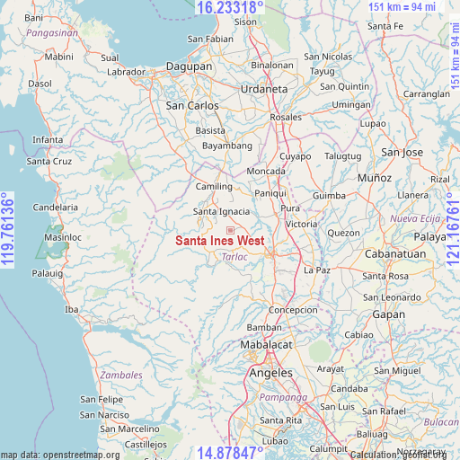
Santa Ines West GPS coordinates[2]
15° 33' 24.984" North, 120° 27' 52.128" East
| Map corner | latitude | longitude |
|---|---|---|
| Upper-left | 16.23318°, | 119.76136° |
| Center: | 15.55694°, | 120.46448° |
| Lower-right: | 14.87847°, | 121.16761° |
| Map W x H: | 150.6×150.6 km | = 93.6×93.6mi |
| max Lat: | 20.78733° ⇑17.7% North |
| Santa Ines West: | 15.55694° |
| min Lat: | ⇓82.3% South 4.65442° |
| min Long | Santa Ines West | max Long |
| 117.04868° | 120.46448° | 126.58417° |
| W 8.3%⇐ | ⇒91.7% E |
Elevation
Elevation of Santa Ines West is 98 m = 322 ft, and this is 10.1 m = 33 ft above average elevation for this country.
| Max E: |
2262 m = 7421 ft | 19.1% |
| Santa Ines West | 98 m 322 ft | |
| Avg. | 87.9 m = 288 ft | |
Min E: |
-2 m = -7 ft | 80.9% |
See also: Philippines elevation on elevation.city.
Geographical zone
Santa Ines West is located in North Torrid zone (between Equator and Tropic of Cancer). Distance of this Northern Tropic circle is 876.1 km =544.4 mi to North.| Distance of | km | miles | from Santa Ines West |
|---|---|---|---|
| North Pole | 8277.3 | 5143.3 | to North |
| Arctic Circle | 5671.4 | 3524 | to North |
| Tropic Cancer | 876.1 | 544.4 | to North |
| Equator | 1729.8 | 1074.8 | to South |


Nearby cities:
15 places around Santa Ines West: (largest is in red/bold)
• Burgos
9.4 km =5.8 mi,  222°
222°
• Calayaan
5.5 km =3.4 mi,  77°
77°
• Mababanaba
6.7 km =4.2 mi,  183°
183°
• Malacampa
11.2 km =7 mi,  329°
329°
• Mamonit
8 km =5 mi,  294°
294°
• Mayantoc
11.7 km =7.3 mi,  306°
306°
• Moriones
10.7 km =6.6 mi, 179°
• Nambalan
4.7 km =2.9 mi,  354°
354°
• Padapada
5.6 km =3.5 mi,  95°
95°
• San Francisco
8.5 km =5.3 mi,  339°
339°
• San Juan de Mata
7.4 km =4.6 mi,  108°
108°
• Santa Ignacia
7.3 km =4.5 mi, 335°
• Santa Maria
10.5 km =6.5 mi, 337°
• Vargas
4.7 km =2.9 mi,  30°
30°
• Villa Aglipay
10.2 km =6.3 mi,  187°
187°
Sources, notices
• [Note1] Compared only with cities in Philippines existing in our database
• [Src1] Map data: © OpenStreetMap contributors (CC-BY-SA)
• [Src2] Other city data from geonames.org with taken over terms of usage.
• [Src3] Geographical zone / Annual Mean Temperature by Robert A. Rohde @ Wikipedia
