Nambalan geodata
Nambalan (Central Luzon) is a populated place; located in Philippines in Asia/Manila (GMT+8) time zone. With population of 2,265 people, there are 3756 cities with bigger population in this country. Compared to other cities in Philippines, 82.8% of cities are located further ↓South; 91.9% of cities are located further →East and 68.5% of cities have lower elevation than Nambalan. Note1
Administrative division(s):
- Level 1: Central Luzon
- Level 2: Province of Tarlac
- Level 3: Santa Ignacia


Nambalan GPS coordinates[2]
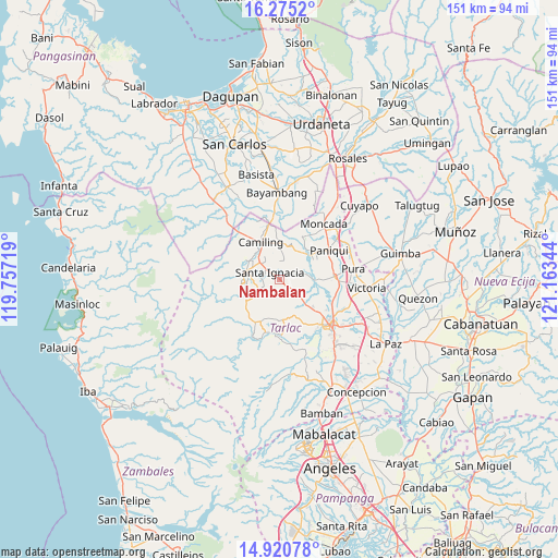
15° 35' 56.796" North, 120° 27' 37.116" East
| Map corner | latitude | longitude |
|---|---|---|
| Upper-left | 16.2752°, | 119.75719° |
| Center: | 15.59911°, | 120.46031° |
| Lower-right: | 14.92078°, | 121.16344° |
| Map W x H: | 150.6×150.6 km | = 93.6×93.6mi |
| max Lat: | 20.78733° ⇑17.2% North |
| Nambalan: | 15.59911° |
| min Lat: | ⇓82.8% South 4.65442° |
| min Long | Nambalan | max Long |
| 117.04868° | 120.46031° | 126.58417° |
| W 8.1%⇐ | ⇒91.9% E |
Elevation
Elevation of Nambalan is 49 m = 161 ft, and this is 38.9 m = 128 ft below average elevation for this country.
| Max E: |
2262 m = 7421 ft | 31.5% |
| Avg. | 87.9 m = 288 ft | |
| Nambalan | 49 m = 161 ft | |
Min E: |
-2 m = -7 ft | 68.5% |
See also: Philippines elevation on elevation.city.
Geographical zone
Nambalan is located in North Torrid zone (between Equator and Tropic of Cancer). Distance of this Northern Tropic circle is 871.5 km =541.5 mi to North.| Distance of | km | miles | from Nambalan |
|---|---|---|---|
| North Pole | 8272.6 | 5140.4 | to North |
| Arctic Circle | 5666.7 | 3521.1 | to North |
| Tropic Cancer | 871.5 | 541.5 | to North |
| Equator | 1734.5 | 1077.8 | to South |


Nearby cities:
15 places around Nambalan: (largest is in red/bold)
• Balaoang
9.2 km =5.7 mi,  39°
39°
• Bobon Second
10.6 km =6.6 mi,  307°
307°
• Calayaan
6.8 km =4.2 mi,  121°
121°
• Mabilang
9 km =5.6 mi,  19°
19°
• Malacampa
7.2 km =4.5 mi, 313°
• Mamonit
7 km =4.3 mi,  259°
259°
• Mayantoc
9.2 km =5.7 mi,  284°
284°
• Padapada
8 km =5 mi,  131°
131°
• San Francisco
4.2 km =2.6 mi,  322°
322°
• San Juan de Mata
10.3 km =6.4 mi, 133°
• Santa Ignacia
3.3 km =2.1 mi, 307°
• Santa Ines West
4.7 km =2.9 mi,  174°
174°
• Santa Maria
6.1 km =3.8 mi, 323°
• Sinilian First
10.5 km =6.5 mi,  359°
359°
• Vargas
2.9 km =1.8 mi,  102°
102°
Sources, notices
• [Note1] Compared only with cities in Philippines existing in our database
• [Src1] Map data: © OpenStreetMap contributors (CC-BY-SA)
• [Src2] Other city data from geonames.org with taken over terms of usage.
• [Src3] Geographical zone / Annual Mean Temperature by Robert A. Rohde @ Wikipedia
