Villa Aglipay geodata
Villa Aglipay (Central Luzon) is a populated place; located in Philippines in Asia/Manila (GMT+8) time zone. With population of 4,800 people, there are 1374 cities with bigger population in this country. Compared to other cities in Philippines, 81.4% of cities are located further ↓South; 92.1% of cities are located further →East and 79.9% of cities have lower elevation than Villa Aglipay. Note1


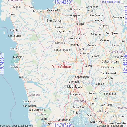
Villa Aglipay GPS coordinates[2]
15° 27' 57.78" North, 120° 27' 9.828" East
| Map corner | latitude | longitude |
|---|---|---|
| Upper-left | 16.14259°, | 119.74961° |
| Center: | 15.46605°, | 120.45273° |
| Lower-right: | 14.78729°, | 121.15586° |
| Map W x H: | 150.7×150.7 km | = 93.6×93.6mi |
| max Lat: | 20.78733° ⇑18.6% North |
| Villa Aglipay: | 15.46605° |
| min Lat: | ⇓81.4% South 4.65442° |
| min Long | Villa Aglipay | max Long |
| 117.04868° | 120.45273° | 126.58417° |
| W 7.9%⇐ | ⇒92.1% E |
Elevation
Elevation of Villa Aglipay is 91 m = 299 ft, and this is 3.1 m = 10 ft above average elevation for this country.
| Max E: |
2262 m = 7421 ft | 20.1% |
| Villa Aglipay | 91 m 299 ft | |
| Avg. | 87.9 m = 288 ft | |
Min E: |
-2 m = -7 ft | 79.9% |
See also: Philippines elevation on elevation.city.
Geographical zone
Villa Aglipay is located in North Torrid zone (between Equator and Tropic of Cancer). Distance of this Northern Tropic circle is 886.3 km =550.7 mi to North.| Distance of | km | miles | from Villa Aglipay |
|---|---|---|---|
| North Pole | 8287.4 | 5149.6 | to North |
| Arctic Circle | 5681.5 | 3530.3 | to North |
| Tropic Cancer | 886.3 | 550.7 | to North |
| Equator | 1719.7 | 1068.6 | to South |


Nearby cities:
15 places around Villa Aglipay: (largest is in red/bold)
• Arminia
12.4 km =7.7 mi,  105°
105°
• Burgos
6.1 km =3.8 mi,  301°
301°
• Calayaan
13.1 km =8.1 mi,  30°
30°
• Cut-cut Primero
14.4 km =8.9 mi,  82°
82°
• Iba
4.7 km =2.9 mi,  253°
253°
• Mababanaba
3.6 km =2.2 mi,  13°
13°
• Mamonit
14.8 km =9.2 mi,  335°
335°
• Moriones
1.5 km =0.9 mi, 111°
• Nambalan
14.8 km =9.2 mi,  3°
3°
• Padapada
11.7 km =7.3 mi,  35°
35°
• San Juan de Mata
11.3 km =7 mi,  47°
47°
• Santa Ines West
10.2 km =6.3 mi, 7°
• Santa Lucia
11.5 km =7.1 mi,  161°
161°
• Sula
6.2 km =3.9 mi,  260°
260°
• Vargas
14.6 km =9.1 mi, 14°
Sources, notices
• [Note1] Compared only with cities in Philippines existing in our database
• [Src1] Map data: © OpenStreetMap contributors (CC-BY-SA)
• [Src2] Other city data from geonames.org with taken over terms of usage.
• [Src3] Geographical zone / Annual Mean Temperature by Robert A. Rohde @ Wikipedia
