Padapada geodata
Padapada (Central Luzon) is a populated place; located in Philippines in Asia/Manila (GMT+8) time zone. With population of 3,016 people, there are 2511 cities with bigger population in this country. Compared to other cities in Philippines, 82.2% of cities are located further ↓South; 90.6% of cities are located further →East and 75.8% of cities have lower elevation than Padapada. Note1
Administrative division(s):
- Level 1: Central Luzon
- Level 2: Province of Tarlac
- Level 3: Santa Ignacia


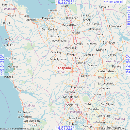
Padapada GPS coordinates[2]
15° 33' 6.12" North, 120° 30' 58.68" East
| Map corner | latitude | longitude |
|---|---|---|
| Upper-left | 16.22795°, | 119.81318° |
| Center: | 15.5517°, | 120.5163° |
| Lower-right: | 14.87322°, | 121.21943° |
| Map W x H: | 150.6×150.6 km | = 93.6×93.6mi |
| max Lat: | 20.78733° ⇑17.8% North |
| Padapada: | 15.5517° |
| min Lat: | ⇓82.2% South 4.65442° |
| min Long | Padapada | max Long |
| 117.04868° | 120.5163° | 126.58417° |
| W 9.4%⇐ | ⇒90.6% E |
Elevation
Elevation of Padapada is 71 m = 233 ft, and this is 16.9 m = 55 ft below average elevation for this country.
| Max E: |
2262 m = 7421 ft | 24.2% |
| Avg. | 87.9 m = 288 ft | |
| Padapada | 71 m = 233 ft | |
Min E: |
-2 m = -7 ft | 75.8% |
See also: Philippines elevation on elevation.city.
Geographical zone
Padapada is located in North Torrid zone (between Equator and Tropic of Cancer). Distance of this Northern Tropic circle is 876.7 km =544.8 mi to North.| Distance of | km | miles | from Padapada |
|---|---|---|---|
| North Pole | 8277.9 | 5143.6 | to North |
| Arctic Circle | 5672 | 3524.4 | to North |
| Tropic Cancer | 876.7 | 544.8 | to North |
| Equator | 1729.2 | 1074.5 | to South |


Nearby cities:
15 places around Padapada: (largest is in red/bold)
• Amacalan
10.7 km =6.6 mi,  71°
71°
• Buenlag
11 km =6.8 mi,  39°
39°
• Bularit
11.4 km =7.1 mi,  80°
80°
• Calayaan
1.8 km =1.1 mi,  353°
353°
• Cardona
8.2 km =5.1 mi, 73°
• Cut-cut Primero
10.7 km =6.6 mi,  135°
135°
• Gerona
10.6 km =6.6 mi,  55°
55°
• Mababanaba
8.5 km =5.3 mi,  224°
224°
• Nambalan
8 km =5 mi,  311°
311°
• San Juan de Mata
2.4 km =1.5 mi, 140°
• Santa Ignacia
11.3 km =7 mi, 310°
• Santa Ines West
5.6 km =3.5 mi,  275°
275°
• Sinait
7.6 km =4.7 mi,  102°
102°
• Tariji
11 km =6.8 mi,  107°
107°
• Vargas
5.6 km =3.5 mi,  325°
325°
Sources, notices
• [Note1] Compared only with cities in Philippines existing in our database
• [Src1] Map data: © OpenStreetMap contributors (CC-BY-SA)
• [Src2] Other city data from geonames.org with taken over terms of usage.
• [Src3] Geographical zone / Annual Mean Temperature by Robert A. Rohde @ Wikipedia
