Vargas geodata
Vargas (Central Luzon) is a populated place; located in Philippines in Asia/Manila (GMT+8) time zone. With population of 2,777 people, there are 2828 cities with bigger population in this country. Compared to other cities in Philippines, 82.7% of cities are located further ↓South; 91.1% of cities are located further →East and 75.5% of cities have lower elevation than Vargas. Note1
Administrative division(s):
- Level 1: Central Luzon
- Level 2: Province of Tarlac
- Level 3: Santa Ignacia


Vargas GPS coordinates[2]
15° 35' 35.952" North, 120° 29' 13.524" East
| Map corner | latitude | longitude |
|---|---|---|
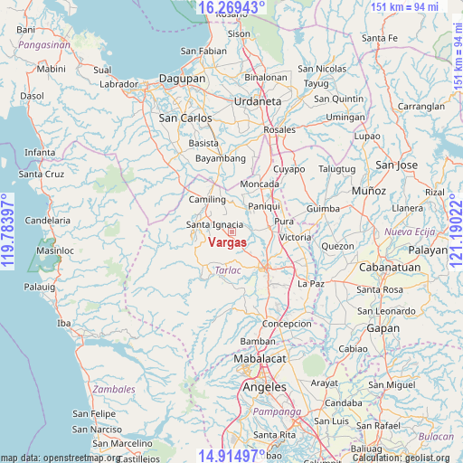
| Upper-left | 16.26943°, | 119.78397° |
| Center: | 15.59332°, | 120.48709° |
| Lower-right: | 14.91497°, | 121.19022° |
| Map W x H: | 150.6×150.6 km | = 93.6×93.6mi |
| max Lat: | 20.78733° ⇑17.3% North |
| Vargas: | 15.59332° |
| min Lat: | ⇓82.7% South 4.65442° |
| min Long | Vargas | max Long |
| 117.04868° | 120.48709° | 126.58417° |
| W 8.9%⇐ | ⇒91.1% E |
Elevation
Elevation of Vargas is 70 m = 230 ft, and this is 17.9 m = 59 ft below average elevation for this country.
| Max E: |
2262 m = 7421 ft | 24.5% |
| Avg. | 87.9 m = 288 ft | |
| Vargas | 70 m = 230 ft | |
Min E: |
-2 m = -7 ft | 75.5% |
See also: Philippines elevation on elevation.city.
Geographical zone
Vargas is located in North Torrid zone (between Equator and Tropic of Cancer). Distance of this Northern Tropic circle is 872.1 km =541.9 mi to North.| Distance of | km | miles | from Vargas |
|---|---|---|---|
| North Pole | 8273.2 | 5140.7 | to North |
| Arctic Circle | 5667.4 | 3521.6 | to North |
| Tropic Cancer | 872.1 | 541.9 | to North |
| Equator | 1733.8 | 1077.3 | to South |


Nearby cities:
15 places around Vargas: (largest is in red/bold)
• Balaoang
8.3 km =5.2 mi,  20°
20°
• Buenlag
10.8 km =6.7 mi,  69°
69°
• Cabayaoasan
10.4 km =6.5 mi,  41°
41°
• Calayaan
4.1 km =2.5 mi,  134°
134°
• Mabilang
9.1 km =5.7 mi,  0°
0°
• Malacampa
9.9 km =6.2 mi,  304°
304°
• Mamonit
9.7 km =6 mi,  265°
265°
• Nambalan
2.9 km =1.8 mi,  282°
282°
• Nancamarinan
10.5 km =6.5 mi,  30°
30°
• Padapada
5.6 km =3.5 mi,  145°
145°
• San Francisco
6.7 km =4.2 mi,  306°
306°
• San Juan de Mata
7.9 km =4.9 mi,  144°
144°
• Santa Ignacia
6.1 km =3.8 mi, 295°
• Santa Ines West
4.7 km =2.9 mi,  210°
210°
• Santa Maria
8.6 km =5.3 mi, 310°
Sources, notices
• [Note1] Compared only with cities in Philippines existing in our database
• [Src1] Map data: © OpenStreetMap contributors (CC-BY-SA)
• [Src2] Other city data from geonames.org with taken over terms of usage.
• [Src3] Geographical zone / Annual Mean Temperature by Robert A. Rohde @ Wikipedia
