San Leonardo geodata
San Leonardo (Central Luzon) is a seat of a third-order administrative division; located in Philippines in Asia/Manila (GMT+8) time zone. With population of 34,743 people, there are 243 cities with bigger population in this country. Compared to other cities in Philippines, 80.4% of cities are located further ↓South; 77.4% of cities are located further →East and 58.8% of cities have lower elevation than San Leonardo. Note1
Administrative division(s):
- Level 1: Central Luzon
- Level 2: Province of Nueva Ecija
- Level 3: San Leonardo


San Leonardo GPS coordinates[2]
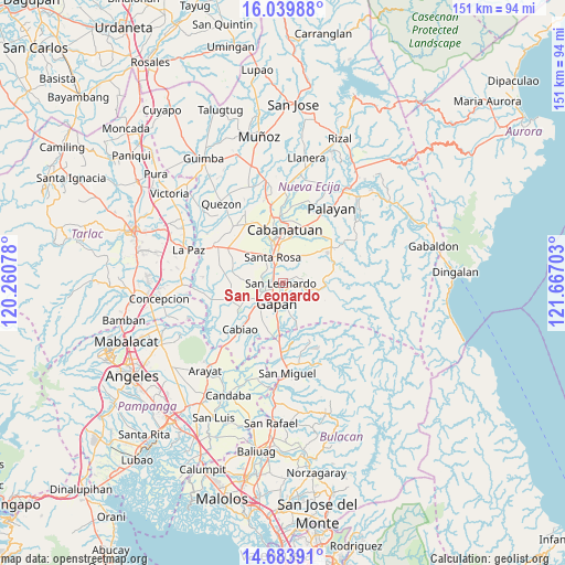
15° 21' 46.8" North, 120° 57' 50.04" East
| Map corner | latitude | longitude |
|---|---|---|
| Upper-left | 16.03988°, | 120.26078° |
| Center: | 15.363°, | 120.9639° |
| Lower-right: | 14.68391°, | 121.66703° |
| Map W x H: | 150.8×150.8 km | = 93.7×93.7mi |
| max Lat: | 20.78733° ⇑19.6% North |
| San Leonardo: | 15.363° |
| min Lat: | ⇓80.4% South 4.65442° |
| min Long | San Leonardo | max Long |
| 117.04868° | 120.9639° | 126.58417° |
| W 22.6%⇐ | ⇒77.4% E |
Elevation
Elevation of San Leonardo is 32 m = 105 ft, and this is 55.9 m = 183 ft below average elevation for this country.
| Max E: |
2262 m = 7421 ft | 41.2% |
| Avg. | 87.9 m = 288 ft | |
| San Leonardo | 32 m = 105 ft | |
Min E: |
-2 m = -7 ft | 58.8% |
See also: Philippines elevation on elevation.city.
Geographical zone
San Leonardo is located in North Torrid zone (between Equator and Tropic of Cancer). Distance of this Northern Tropic circle is 897.7 km =557.8 mi to North.| Distance of | km | miles | from San Leonardo |
|---|---|---|---|
| North Pole | 8298.9 | 5156.7 | to North |
| Arctic Circle | 5693 | 3537.5 | to North |
| Tropic Cancer | 897.7 | 557.8 | to North |
| Equator | 1708.2 | 1061.4 | to South |


Nearby cities:
15 places around San Leonardo: (largest is in red/bold)
• Alua
9.4 km =5.8 mi,  232°
232°
• Gapan
6.5 km =4 mi,  196°
196°
• General Tinio
9.1 km =5.7 mi,  98°
98°
• Jaen
6.2 km =3.9 mi, 230°
• Lambakin
11.1 km =6.9 mi,  275°
275°
• Nieves
4.2 km =2.6 mi, 202°
• Peñaranda
4.5 km =2.8 mi,  107°
107°
• Putlod
10.4 km =6.5 mi,  274°
274°
• San Anton
5 km =3.1 mi,  250°
250°
• San Mariano
10.5 km =6.5 mi,  243°
243°
• Santa Rosa
7.3 km =4.5 mi,  337°
337°
• Santo Cristo
10.8 km =6.7 mi, 227°
• Santo Rosario
11.2 km =7 mi,  314°
314°
• Soledad
7.6 km =4.7 mi,  16°
16°
• Tabuating
4.1 km =2.5 mi,  322°
322°
Sources, notices
• [Note1] Compared only with cities in Philippines existing in our database
• [Src1] Map data: © OpenStreetMap contributors (CC-BY-SA)
• [Src2] Other city data from geonames.org with taken over terms of usage.
• [Src3] Geographical zone / Annual Mean Temperature by Robert A. Rohde @ Wikipedia
