Lanat geodata
Lanat (Central Luzon) is a populated place; located in Philippines in Asia/Manila (GMT+8) time zone. With population of 2,178 people, there are 3928 cities with bigger population in this country. Compared to other cities in Philippines, 84.7% of cities are located further ↓South; 87.9% of cities are located further →East and 56.6% of cities have lower elevation than Lanat. Note1


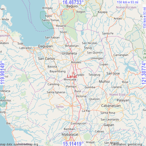
Lanat GPS coordinates[2]
15° 47' 30.804" North, 120° 36' 16.596" East
| Map corner | latitude | longitude |
|---|---|---|
| Upper-left | 16.46733°, | 119.90149° |
| Center: | 15.79189°, | 120.60461° |
| Lower-right: | 15.11419°, | 121.30774° |
| Map W x H: | 150.5×150.5 km | = 93.5×93.5mi |
| max Lat: | 20.78733° ⇑15.3% North |
| Lanat: | 15.79189° |
| min Lat: | ⇓84.7% South 4.65442° |
| min Long | Lanat | max Long |
| 117.04868° | 120.60461° | 126.58417° |
| W 12.1%⇐ | ⇒87.9% E |
Elevation
Elevation of Lanat is 29 m = 95 ft, and this is 58.9 m = 193 ft below average elevation for this country.
| Max E: |
2262 m = 7421 ft | 43.4% |
| Avg. | 87.9 m = 288 ft | |
| Lanat | 29 m = 95 ft | |
Min E: |
-2 m = -7 ft | 56.6% |
See also: Philippines elevation on elevation.city.
Geographical zone
Lanat is located in North Torrid zone (between Equator and Tropic of Cancer). Distance of this Northern Tropic circle is 850 km =528.2 mi to North.| Distance of | km | miles | from Lanat |
|---|---|---|---|
| North Pole | 8251.2 | 5127.1 | to North |
| Arctic Circle | 5645.3 | 3507.8 | to North |
| Tropic Cancer | 850 | 528.2 | to North |
| Equator | 1755.9 | 1091.1 | to South |


Nearby cities:
15 places around Lanat: (largest is in red/bold)
• Anao
7.3 km =4.5 mi,  162°
162°
• Baquero Norte
10 km =6.2 mi,  212°
212°
• Bued
7 km =4.3 mi,  44°
44°
• Burgos
7.8 km =4.8 mi, 206°
• Calancuasan Norte
4 km =2.5 mi,  74°
74°
• Cuyapo
6.5 km =4 mi,  99°
99°
• Guiling
5.8 km =3.6 mi,  11°
11°
• Moncada
7.1 km =4.4 mi, 207°
• Nampicuan
7.1 km =4.4 mi, 162°
• Pindangan Centro
9.5 km =5.9 mi,  323°
323°
• Salcedo
7.3 km =4.5 mi,  356°
356°
• San Felipe
3.9 km =2.4 mi,  348°
348°
• San Manuel
0.9 km =0.6 mi,  27°
27°
• San Pedro Apartado
6.6 km =4.1 mi, 319°
• Villanueva
6.3 km =3.9 mi,  276°
276°
Sources, notices
• [Note1] Compared only with cities in Philippines existing in our database
• [Src1] Map data: © OpenStreetMap contributors (CC-BY-SA)
• [Src2] Other city data from geonames.org with taken over terms of usage.
• [Src3] Geographical zone / Annual Mean Temperature by Robert A. Rohde @ Wikipedia
