Cagsiay geodata
Cagsiay (Calabarzon) is a populated place; located in Philippines in Asia/Manila (GMT+8) time zone. With population of 10,173 people, there are 600 cities with bigger population in this country. Compared to other cities in Philippines, 72.1% of cities are located further ↓South; 63.3% of cities are located further →East and 53.5% of cities have lower elevation than Cagsiay. Note1


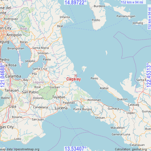
Cagsiay GPS coordinates[2]
14° 13' 0.012" North, 121° 45' 0" East
| Map corner | latitude | longitude |
|---|---|---|
| Upper-left | 14.89722°, | 121.04688° |
| Center: | 14.21667°, | 121.75° |
| Lower-right: | 13.53407°, | 122.45313° |
| Map W x H: | 151.6×151.6 km | = 94.2×94.2mi |
| max Lat: | 20.78733° ⇑27.9% North |
| Cagsiay: | 14.21667° |
| min Lat: | ⇓72.1% South 4.65442° |
| min Long | Cagsiay | max Long |
| 117.04868° | 121.75° | 126.58417° |
| W 36.7%⇐ | ⇒63.3% E |
Elevation
Elevation of Cagsiay is 26 m = 85 ft, and this is 61.9 m = 203 ft below average elevation for this country.
| Max E: |
2262 m = 7421 ft | 46.5% |
| Avg. | 87.9 m = 288 ft | |
| Cagsiay | 26 m = 85 ft | |
Min E: |
-2 m = -7 ft | 53.5% |
See also: Philippines elevation on elevation.city.
Geographical zone
Cagsiay is located in North Torrid zone (between Equator and Tropic of Cancer). Distance of this Northern Tropic circle is 1025.2 km =637 mi to North.| Distance of | km | miles | from Cagsiay |
|---|---|---|---|
| North Pole | 8426.3 | 5235.9 | to North |
| Arctic Circle | 5820.4 | 3616.6 | to North |
| Tropic Cancer | 1025.2 | 637 | to North |
| Equator | 1580.7 | 982.2 | to South |


Nearby cities:
15 places around Cagsiay: (largest is in red/bold)
• Binahaan
25 km =15.5 mi,  179°
179°
• Cavinti
26.3 km =16.3 mi,  276°
276°
• Kalayaan
24.7 km =15.3 mi,  306°
306°
• Lucban
23.9 km =14.9 mi,  241°
241°
• Luisiana
26 km =16.2 mi,  262°
262°
• Mainit Norte
26 km =16.2 mi,  102°
102°
• Malicboy
26.5 km =16.5 mi,  170°
170°
• Malinao Ilaya
26.2 km =16.3 mi,  159°
159°
• Mauban
3.5 km =2.2 mi,  215°
215°
• Pagbilao
28.3 km =17.6 mi,  191°
191°
• Perez
19.2 km =11.9 mi, 97°
• Sampaloc
13.3 km =8.3 mi, 243°
• San Antonio
27 km =16.8 mi,  266°
266°
• Santo Tomas
27.2 km =16.9 mi, 262°
• Tayabas
27.1 km =16.8 mi, 218°
Sources, notices
• [Note1] Compared only with cities in Philippines existing in our database
• [Src1] Map data: © OpenStreetMap contributors (CC-BY-SA)
• [Src2] Other city data from geonames.org with taken over terms of usage.
• [Src3] Geographical zone / Annual Mean Temperature by Robert A. Rohde @ Wikipedia
