Athmuqam geodata
Athmuqam (Azad Kashmir) is a seat of a second-order administrative division; located in Pakistan in Asia/Karachi (GMT+5) time zone. In our database, there are 416 cities with bigger population. Compared to other cities in Pakistan, 95.7% of cities are located further ↓South; 88.3% of cities are located further ←West and 93.5% of cities have lower elevation than Athmuqam. Note1


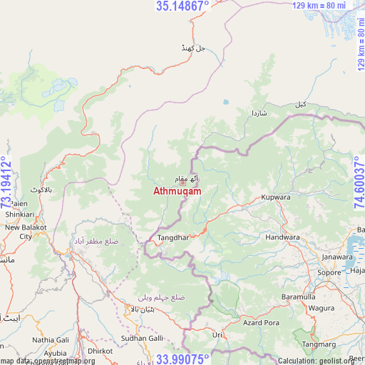
Athmuqam GPS coordinates[2]
34° 34' 18.228" North, 73° 53' 50.064" East
| Map corner | latitude | longitude |
|---|---|---|
| Upper-left | 35.14867°, | 73.19412° |
| Center: | 34.57173°, | 73.89724° |
| Lower-right: | 33.99075°, | 74.60037° |
| Map W x H: | 128.7×128.7 km | = 80×80mi |
| max Lat: | 36.32162° ⇑4.3% North |
| Athmuqam: | 34.57173° |
| min Lat: | ⇓95.7% South 24.14422° |
| min Long | Athmuqam | max Long |
| 61.74573° | 73.89724° | 75.63372° |
| W 88.3%⇐ | ⇒11.7% E |
Elevation
Elevation of Athmuqam is 1386 m = 4547 ft, and this is 1041 m = 3415 ft above average elevation for this country.
| Max E: |
2732 m = 8963 ft | 6.5% |
| Athmuqam | 1386 m 4547 ft | |
| Avg. | 345 m = 1132 ft | |
Min E: |
3 m = 10 ft | 93.5% |
See also: Pakistan elevation on elevation.city.
Geographical zone
Athmuqam is located in North temperate zone (between Tropic of Cancer and the Arctic Circle). Distance of this Northern Tropic circle is 1238.1 km =769.3 mi to South.| Distance of | km | miles | from Athmuqam |
|---|---|---|---|
| North Pole | 6163 | 3829.5 | to North |
| Arctic Circle | 3557.2 | 2210.3 | to North |
| Tropic Cancer | 1238.1 | 769.3 | to South |
| Equator | 3844 | 2388.6 | to South |


Nearby cities:
15 places around Athmuqam: (largest is in red/bold)
• Abbottabad
78.7 km =48.9 mi,  233°
233°
• Amirabad
85.5 km =53.1 mi,  239°
239°
• Baffa
63.5 km =39.5 mi,  256°
256°
• Bagh
66.6 km =41.4 mi,  189°
189°
• Battagram
80.8 km =50.2 mi,  278°
278°
• Chilas
95.4 km =59.3 mi,  11°
11°
• Dasu
97.3 km =60.5 mi,  325°
325°
• Hattian Bala
46.9 km =29.1 mi,  197°
197°
• Havelian
88.9 km =55.2 mi, 229°
• Kamra
98.3 km =61.1 mi, 201°
• Mansehra
69.6 km =43.2 mi,  247°
247°
• Murree
87.2 km =54.2 mi,  212°
212°
• Muzaffarābād
45.1 km =28 mi, 240°
• Rawala Kot
80.4 km =50 mi, 189°
• Shingli Bala
84.3 km =52.4 mi, 278°
Sources, notices
• [Note1] Compared only with cities in Pakistan existing in our database
• [Src1] Map data: © OpenStreetMap contributors (CC-BY-SA)
• [Src2] Other city data from geonames.org with taken over terms of usage.
• [Src3] Geographical zone / Annual Mean Temperature by Robert A. Rohde @ Wikipedia
