Chilas geodata
Chilas (Gilgit-Baltistan) is a seat of a second-order administrative division; located in Pakistan in Asia/Karachi (GMT+5) time zone. In our database, there are 416 cities with bigger population. Compared to other cities in Pakistan, 98.6% of cities are located further ↓South; 91.2% of cities are located further ←West and 92.3% of cities have lower elevation than Chilas. Note1


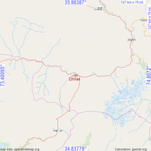
Chilas GPS coordinates[2]
35° 24' 46.332" North, 74° 6' 14.652" East
| Map corner | latitude | longitude |
|---|---|---|
| Upper-left | 35.98387°, | 73.40095° |
| Center: | 35.41287°, | 74.10407° |
| Lower-right: | 34.83779°, | 74.8072° |
| Map W x H: | 127.4×127.4 km | = 79.2×79.2mi |
| max Lat: | 36.32162° ⇑1.4% North |
| Chilas: | 35.41287° |
| min Lat: | ⇓98.6% South 24.14422° |
| min Long | Chilas | max Long |
| 61.74573° | 74.10407° | 75.63372° |
| W 91.2%⇐ | ⇒8.8% E |
Elevation
Elevation of Chilas is 1279 m = 4196 ft, and this is 934 m = 3064 ft above average elevation for this country.
| Max E: |
2732 m = 8963 ft | 7.7% |
| Chilas | 1279 m 4196 ft | |
| Avg. | 345 m = 1132 ft | |
Min E: |
3 m = 10 ft | 92.3% |
See also: Pakistan elevation on elevation.city.
Geographical zone
Chilas is located in North temperate zone (between Tropic of Cancer and the Arctic Circle). Distance of this Northern Tropic circle is 1331.6 km =827.4 mi to South.| Distance of | km | miles | from Chilas |
|---|---|---|---|
| North Pole | 6069.5 | 3771.4 | to North |
| Arctic Circle | 3463.6 | 2152.2 | to North |
| Tropic Cancer | 1331.6 | 827.4 | to South |
| Equator | 3937.5 | 2446.6 | to South |


Nearby cities:
15 places around Chilas: (largest is in red/bold)
• Aliabad
109.6 km =68.1 mi,  24°
24°
• Alpurai
144.5 km =89.8 mi,  247°
247°
• Athmuqam
95.4 km =59.3 mi,  191°
191°
• Baffa
134.9 km =83.8 mi,  216°
216°
• Barishal
114.2 km =71 mi,  27°
27°
• Battagram
127.9 km =79.5 mi,  230°
230°
• Dasu
75 km =46.6 mi,  259°
259°
• Eidgah
68.6 km =42.6 mi,  96°
96°
• Gakuch
90.3 km =56.1 mi,  340°
340°
• Gilgit
59.3 km =36.8 mi, 18°
• Hattian Bala
142.2 km =88.4 mi, 193°
• Mansehra
146.1 km =90.8 mi,  214°
214°
• Muzaffarābād
129.5 km =80.5 mi, 206°
• Shingli Bala
130.5 km =81.1 mi, 231°
• Skardu
139.3 km =86.6 mi, 95°
Sources, notices
• [Note1] Compared only with cities in Pakistan existing in our database
• [Src1] Map data: © OpenStreetMap contributors (CC-BY-SA)
• [Src2] Other city data from geonames.org with taken over terms of usage.
• [Src3] Geographical zone / Annual Mean Temperature by Robert A. Rohde @ Wikipedia
