Shingli Bala geodata
Shingli Bala (Khyber Pakhtunkhwa) is a populated place; located in Pakistan in Asia/Karachi (GMT+5) time zone. With population of 4,000 people, there are 387 cities with bigger population in this country. Compared to other cities in Pakistan, 96.4% of cities are located further ↓South; 71.8% of cities are located further ←West and 90.1% of cities have lower elevation than Shingli Bala. Note1
Administrative division(s):
- Level 1: Khyber Pakhtunkhwa
- Level 2: Battagram District
- Level 3: Battagram Tehsil


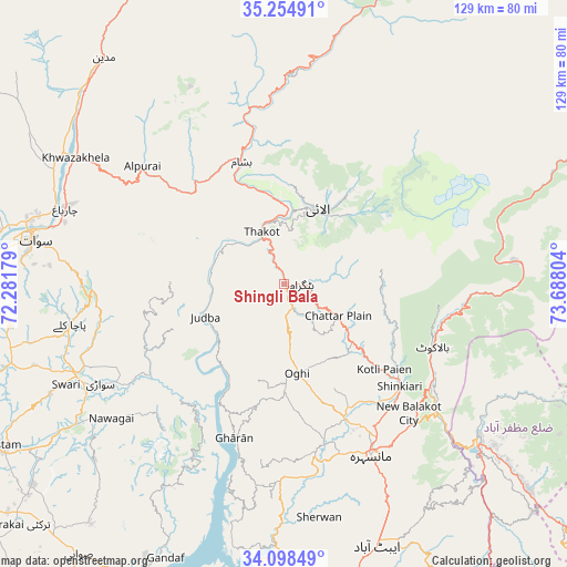
Shingli Bala GPS coordinates[2]
34° 40' 43.392" North, 72° 59' 5.676" East
| Map corner | latitude | longitude |
|---|---|---|
| Upper-left | 35.25491°, | 72.28179° |
| Center: | 34.67872°, | 72.98491° |
| Lower-right: | 34.09849°, | 73.68804° |
| Map W x H: | 128.6×128.6 km | = 79.9×79.9mi |
| max Lat: | 36.32162° ⇑3.6% North |
| Shingli Bala: | 34.67872° |
| min Lat: | ⇓96.4% South 24.14422° |
| min Long | Shingli Bala | max Long |
| 61.74573° | 72.98491° | 75.63372° |
| W 71.8%⇐ | ⇒28.2% E |
Elevation
Elevation of Shingli Bala is 1041 m = 3415 ft, and this is 696 m = 2283 ft above average elevation for this country.
| Max E: |
2732 m = 8963 ft | 9.9% |
| Shingli Bala | 1041 m 3415 ft | |
| Avg. | 345 m = 1132 ft | |
Min E: |
3 m = 10 ft | 90.1% |
See also: Pakistan elevation on elevation.city.
Geographical zone
Shingli Bala is located in North temperate zone (between Tropic of Cancer and the Arctic Circle). Distance of this Northern Tropic circle is 1250 km =776.7 mi to South.| Distance of | km | miles | from Shingli Bala |
|---|---|---|---|
| North Pole | 6151.1 | 3822.1 | to North |
| Arctic Circle | 3545.3 | 2202.9 | to North |
| Tropic Cancer | 1250 | 776.7 | to South |
| Equator | 3855.9 | 2395.9 | to South |


Nearby cities:
15 places around Shingli Bala: (largest is in red/bold)
• Abbottabad
62.7 km =39 mi,  160°
160°
• Alpurai
41.9 km =26 mi,  309°
309°
• Amirabad
55.5 km =34.5 mi,  169°
169°
• Baffa
34.6 km =21.5 mi,  140°
140°
• Battagram
3.5 km =2.2 mi,  92°
92°
• Daggar
49.5 km =30.8 mi,  247°
247°
• Dasu
73.6 km =45.7 mi,  22°
22°
• Haripur
75.8 km =47.1 mi,  183°
183°
• Havelian
71.4 km =44.4 mi, 166°
• Khalabat
69.4 km =43.1 mi,  187°
187°
• Mansehra
43.3 km =26.9 mi,  153°
153°
• Mingora
58 km =36 mi,  281°
281°
• Muzaffarābād
56.2 km =34.9 mi,  127°
127°
• Saidu Sharif
58 km =36 mi, 277°
• Topi
75.4 km =46.9 mi,  206°
206°
Sources, notices
• [Note1] Compared only with cities in Pakistan existing in our database
• [Src1] Map data: © OpenStreetMap contributors (CC-BY-SA)
• [Src2] Other city data from geonames.org with taken over terms of usage.
• [Src3] Geographical zone / Annual Mean Temperature by Robert A. Rohde @ Wikipedia
