Rawala Kot geodata
Rawala Kot (Azad Kashmir) is a seat of a second-order administrative division; located in Pakistan in Asia/Karachi (GMT+5) time zone. With population of 50,000 people, there are 129 cities with bigger population in this country. Compared to other cities in Pakistan, 87.8% of cities are located further ↓South; 85.8% of cities are located further ←West and 96.2% of cities have lower elevation than Rawala Kot. Note1


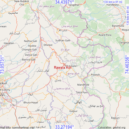
Rawala Kot GPS coordinates[2]
33° 51' 28.152" North, 73° 45' 37.548" East
| Map corner | latitude | longitude |
|---|---|---|
| Upper-left | 34.43971°, | 73.05731° |
| Center: | 33.85782°, | 73.76043° |
| Lower-right: | 33.27194°, | 74.46356° |
| Map W x H: | 129.8×129.8 km | = 80.7×80.7mi |
| max Lat: | 36.32162° ⇑12.2% North |
| Rawala Kot: | 33.85782° |
| min Lat: | ⇓87.8% South 24.14422° |
| min Long | Rawala Kot | max Long |
| 61.74573° | 73.76043° | 75.63372° |
| W 85.8%⇐ | ⇒14.2% E |
Elevation
Elevation of Rawala Kot is 1640 m = 5381 ft, and this is 1295 m = 4249 ft above average elevation for this country.
| Max E: |
2732 m = 8963 ft | 3.8% |
| Rawala Kot | 1640 m 5381 ft | |
| Avg. | 345 m = 1132 ft | |
Min E: |
3 m = 10 ft | 96.2% |
See also: Rawala Kot elevation on elevation.city.
Geographical zone
Rawala Kot is located in North temperate zone (between Tropic of Cancer and the Arctic Circle). Distance of this Northern Tropic circle is 1158.7 km =720 mi to South.| Distance of | km | miles | from Rawala Kot |
|---|---|---|---|
| North Pole | 6242.4 | 3878.8 | to North |
| Arctic Circle | 3636.5 | 2259.6 | to North |
| Tropic Cancer | 1158.7 | 720 | to South |
| Equator | 3764.6 | 2339.2 | to South |


Nearby cities:
15 places around Rawala Kot: (largest is in red/bold)
• Abbottabad
59.9 km =37.2 mi,  302°
302°
• Amirabad
71.8 km =44.6 mi, 300°
• Bagh
13.8 km =8.6 mi,  6°
6°
• Haripur
77.7 km =48.3 mi,  281°
281°
• Hattian Bala
34.6 km =21.5 mi,  357°
357°
• Havelian
59.5 km =37 mi,  291°
291°
• Islamabad
68 km =42.3 mi,  257°
257°
• Kahuta
45.4 km =28.2 mi,  229°
229°
• Kamra
26 km =16.2 mi,  241°
241°
• Kotli
40 km =24.9 mi,  160°
160°
• Mansehra
73.8 km =45.9 mi,  315°
315°
• Murree
34.6 km =21.5 mi, 279°
• Muzaffarābād
62.9 km =39.1 mi,  334°
334°
• Nazir Town
66.5 km =41.3 mi,  202°
202°
• Rawalpindi
72 km =44.7 mi,  246°
246°
Sources, notices
• [Note1] Compared only with cities in Pakistan existing in our database
• [Src1] Map data: © OpenStreetMap contributors (CC-BY-SA)
• [Src2] Other city data from geonames.org with taken over terms of usage.
• [Src3] Geographical zone / Annual Mean Temperature by Robert A. Rohde @ Wikipedia
