Muzaffarābād geodata
Muzaffarābād (Azad Kashmir) is a seat of a first-order administrative division; located in Pakistan in Asia/Karachi (GMT+5) time zone. With population of 725,000 people, there are 10 cities with bigger population in this country. Compared to other cities in Pakistan, 94.8% of cities are located further ↓South; 80.8% of cities are located further ←West and 85.6% of cities have lower elevation than Muzaffarābād. Note1


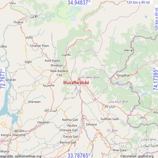
Muzaffarābād GPS coordinates[2]
34° 22' 12.072" North, 73° 28' 14.952" East
| Map corner | latitude | longitude |
|---|---|---|
| Upper-left | 34.94837°, | 72.7677° |
| Center: | 34.37002°, | 73.47082° |
| Lower-right: | 33.78765°, | 74.17395° |
| Map W x H: | 129.1×129.1 km | = 80.2×80.2mi |
| max Lat: | 36.32162° ⇑5.2% North |
| Muzaffarābād: | 34.37002° |
| min Lat: | ⇓94.8% South 24.14422° |
| min Long | Muzaffarābād | max Long |
| 61.74573° | 73.47082° | 75.63372° |
| W 80.8%⇐ | ⇒19.2% E |
Elevation
Elevation of Muzaffarābād is 739 m = 2425 ft, and this is 394 m = 1293 ft above average elevation for this country.
| Max E: |
2732 m = 8963 ft | 14.4% |
| Muzaffarābād | 739 m 2425 ft | |
| Avg. | 345 m = 1132 ft | |
Min E: |
3 m = 10 ft | 85.6% |
See also: Muzaffarābād elevation on elevation.city.
Geographical zone
Muzaffarābād is located in North temperate zone (between Tropic of Cancer and the Arctic Circle). Distance of this Northern Tropic circle is 1215.7 km =755.4 mi to South.| Distance of | km | miles | from Muzaffarābād |
|---|---|---|---|
| North Pole | 6185.5 | 3843.5 | to North |
| Arctic Circle | 3579.6 | 2224.3 | to North |
| Tropic Cancer | 1215.7 | 755.4 | to South |
| Equator | 3821.6 | 2374.6 | to South |


Nearby cities:
15 places around Muzaffarābād: (largest is in red/bold)
• Abbottabad
34.4 km =21.4 mi,  223°
223°
• Amirabad
40.4 km =25.1 mi,  239°
239°
• Athmuqam
45.1 km =28 mi,  60°
60°
• Baffa
23.9 km =14.9 mi,  288°
288°
• Bagh
51.6 km =32.1 mi,  147°
147°
• Battagram
53.4 km =33.2 mi,  309°
309°
• Haripur
64.4 km =40 mi,  229°
229°
• Hattian Bala
33.5 km =20.8 mi,  131°
131°
• Havelian
45.3 km =28.1 mi, 219°
• Kamra
69.4 km =43.1 mi,  176°
176°
• Khalabat
63.6 km =39.5 mi, 237°
• Mansehra
25.5 km =15.8 mi,  260°
260°
• Murree
51.9 km =32.2 mi,  188°
188°
• Rawala Kot
62.9 km =39.1 mi, 154°
• Shingli Bala
56.2 km =34.9 mi, 307°
Sources, notices
• [Note1] Compared only with cities in Pakistan existing in our database
• [Src1] Map data: © OpenStreetMap contributors (CC-BY-SA)
• [Src2] Other city data from geonames.org with taken over terms of usage.
• [Src3] Geographical zone / Annual Mean Temperature by Robert A. Rohde @ Wikipedia
