Zhob geodata
Zhob (Balochistan) is a seat of a second-order administrative division; located in Pakistan in Asia/Karachi (GMT+5) time zone. With population of 50,537 people, there are 127 cities with bigger population in this country. Compared to other cities in Pakistan, 57.6% of cities are located further ↓South; 66.1% of cities are located further →East and 94.1% of cities have lower elevation than Zhob. Note1


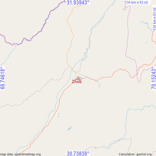
Zhob GPS coordinates[2]
31° 20' 26.952" North, 69° 26' 57.48" East
| Map corner | latitude | longitude |
|---|---|---|
| Upper-left | 31.93943°, | 68.74618° |
| Center: | 31.34082°, | 69.4493° |
| Lower-right: | 30.73838°, | 70.15243° |
| Map W x H: | 133.5×133.5 km | = 83×83mi |
| max Lat: | 36.32162° ⇑42.4% North |
| Zhob: | 31.34082° |
| min Lat: | ⇓57.6% South 24.14422° |
| min Long | Zhob | max Long |
| 61.74573° | 69.4493° | 75.63372° |
| W 33.9%⇐ | ⇒66.1% E |
Elevation
Elevation of Zhob is 1409 m = 4623 ft, and this is 1064 m = 3491 ft above average elevation for this country.
| Max E: |
2732 m = 8963 ft | 5.9% |
| Zhob | 1409 m 4623 ft | |
| Avg. | 345 m = 1132 ft | |
Min E: |
3 m = 10 ft | 94.1% |
See also: Zhob elevation on elevation.city.
Geographical zone
Zhob is located in North temperate zone (between Tropic of Cancer and the Arctic Circle). Distance of this Northern Tropic circle is 878.9 km =546.1 mi to South.| Distance of | km | miles | from Zhob |
|---|---|---|---|
| North Pole | 6522.3 | 4052.8 | to North |
| Arctic Circle | 3916.4 | 2433.5 | to North |
| Tropic Cancer | 878.9 | 546.1 | to South |
| Equator | 3484.8 | 2165.4 | to South |


Nearby cities:
15 places around Zhob: (largest is in red/bold)
• Bakhri Ahmad Khan
148.4 km =92.2 mi,  116°
116°
• Basti Aukharvand
148.3 km =92.1 mi, 115°
• Basti Dosa
148.5 km =92.3 mi,  114°
114°
• Dera Ismail Khan
148 km =92 mi,  68°
68°
• Karor
143.3 km =89 mi,  95°
95°
• Kulachi
116 km =72.1 mi,  55°
55°
• Layyah
147.9 km =91.9 mi, 106°
• Loralai
135.1 km =83.9 mi,  216°
216°
• Moza Shahwala
146 km =90.7 mi, 114°
• Musa Khel Bazar
64.2 km =39.9 mi,  146°
146°
• Qila Saifullah
125.9 km =78.2 mi,  235°
235°
• Shorkot
149.3 km =92.8 mi, 64°
• Tank
131.5 km =81.7 mi,  42°
42°
• Taunsa
134.6 km =83.6 mi, 121°
• Wana
107.2 km =66.6 mi,  6°
6°
Sources, notices
• [Note1] Compared only with cities in Pakistan existing in our database
• [Src1] Map data: © OpenStreetMap contributors (CC-BY-SA)
• [Src2] Other city data from geonames.org with taken over terms of usage.
• [Src3] Geographical zone / Annual Mean Temperature by Robert A. Rohde @ Wikipedia
