Wana geodata
Wana (FATA) is a populated place; located in Pakistan in Asia/Karachi (GMT+5) time zone. With population of 2,223 people, there are 395 cities with bigger population in this country. Compared to other cities in Pakistan, 71.6% of cities are located further ↓South; 65% of cities are located further →East and 93.7% of cities have lower elevation than Wana. Note1


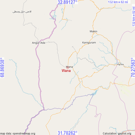
Wana GPS coordinates[2]
32° 17' 56.004" North, 69° 34' 21" East
| Map corner | latitude | longitude |
|---|---|---|
| Upper-left | 32.89127°, | 68.86938° |
| Center: | 32.29889°, | 69.5725° |
| Lower-right: | 31.70262°, | 70.27563° |
| Map W x H: | 132.2×132.2 km | = 82.1×82.1mi |
| max Lat: | 36.32162° ⇑28.4% North |
| Wana: | 32.29889° |
| min Lat: | ⇓71.6% South 24.14422° |
| min Long | Wana | max Long |
| 61.74573° | 69.5725° | 75.63372° |
| W 35%⇐ | ⇒65% E |
Elevation
Elevation of Wana is 1390 m = 4560 ft, and this is 1045 m = 3428 ft above average elevation for this country.
| Max E: |
2732 m = 8963 ft | 6.3% |
| Wana | 1390 m 4560 ft | |
| Avg. | 345 m = 1132 ft | |
Min E: |
3 m = 10 ft | 93.7% |
See also: Pakistan elevation on elevation.city.
Geographical zone
Wana is located in North temperate zone (between Tropic of Cancer and the Arctic Circle). Distance of this Northern Tropic circle is 985.4 km =612.3 mi to South.| Distance of | km | miles | from Wana |
|---|---|---|---|
| North Pole | 6415.8 | 3986.6 | to North |
| Arctic Circle | 3809.9 | 2367.4 | to North |
| Tropic Cancer | 985.4 | 612.3 | to South |
| Equator | 3591.3 | 2231.5 | to South |


Nearby cities:
15 places around Wana: (largest is in red/bold)
• Alizai
155.4 km =96.6 mi,  27°
27°
• Bannu
123.1 km =76.5 mi,  51°
51°
• Bhakkar
159.4 km =99 mi,  117°
117°
• Darya Khan
155.1 km =96.4 mi,  111°
111°
• Dera Ismail Khan
135.6 km =84.3 mi, 112°
• Gulishah Kach
83 km =51.6 mi,  60°
60°
• Kalur Kot
160.1 km =99.5 mi,  95°
95°
• Kulachi
93 km =57.8 mi, 116°
• Lakki
130.3 km =81 mi,  74°
74°
• Miran Shah
90.9 km =56.5 mi, 30°
• Paharpur
133.3 km =82.8 mi, 99°
• Sarai Naurang
127.5 km =79.2 mi, 62°
• Shorkot
130.3 km =81 mi, 109°
• Tank
76.8 km =47.7 mi, 96°
• Zhob
107.2 km =66.6 mi,  186°
186°
Sources, notices
• [Note1] Compared only with cities in Pakistan existing in our database
• [Src1] Map data: © OpenStreetMap contributors (CC-BY-SA)
• [Src2] Other city data from geonames.org with taken over terms of usage.
• [Src3] Geographical zone / Annual Mean Temperature by Robert A. Rohde @ Wikipedia
