Shorkot geodata
Shorkot (Khyber Pakhtunkhwa) is a populated place; located in Pakistan in Asia/Karachi (GMT+5) time zone. With population of 67,439 people, there are 103 cities with bigger population in this country. Compared to other cities in Pakistan, 65% of cities are located further ↓South; 56.9% of cities are located further →East and 51% of cities have lower elevation than Shorkot. Note1


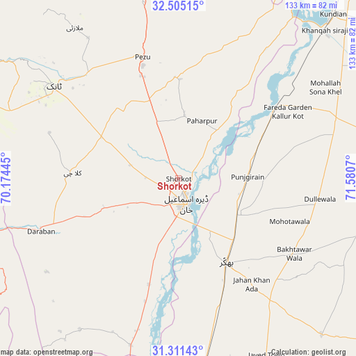
Shorkot GPS coordinates[2]
31° 54' 36.828" North, 70° 52' 39.252" East
| Map corner | latitude | longitude |
|---|---|---|
| Upper-left | 32.50515°, | 70.17445° |
| Center: | 31.91023°, | 70.87757° |
| Lower-right: | 31.31143°, | 71.5807° |
| Map W x H: | 132.7×132.7 km | = 82.5×82.5mi |
| max Lat: | 36.32162° ⇑35% North |
| Shorkot: | 31.91023° |
| min Lat: | ⇓65% South 24.14422° |
| min Long | Shorkot | max Long |
| 61.74573° | 70.87757° | 75.63372° |
| W 43.1%⇐ | ⇒56.9% E |
Elevation
Elevation of Shorkot is 182 m = 597 ft, and this is 163 m = 535 ft below average elevation for this country.
| Max E: |
2732 m = 8963 ft | 49% |
| Avg. | 345 m = 1132 ft | |
| Shorkot | 182 m = 597 ft | |
Min E: |
3 m = 10 ft | 51% |
See also: Shorkot elevation on elevation.city.
Geographical zone
Shorkot is located in North temperate zone (between Tropic of Cancer and the Arctic Circle). Distance of this Northern Tropic circle is 942.2 km =585.5 mi to South.| Distance of | km | miles | from Shorkot |
|---|---|---|---|
| North Pole | 6459 | 4013.4 | to North |
| Arctic Circle | 3853.1 | 2394.2 | to North |
| Tropic Cancer | 942.2 | 585.5 | to South |
| Equator | 3548.1 | 2204.7 | to South |


Nearby cities:
15 places around Shorkot: (largest is in red/bold)
• Bhakkar
36.1 km =22.4 mi,  150°
150°
• Chak Two Hundred Forty-nine Thal Development Authority
87.2 km =54.2 mi,  159°
159°
• Darya Khan
25.4 km =15.8 mi,  123°
123°
• Dera Ismail Khan
9.1 km =5.7 mi,  165°
165°
• Dullewala
53.4 km =33.2 mi,  99°
99°
• Harnoli
75.8 km =47.1 mi,  57°
57°
• Kalur Kot
45.7 km =28.4 mi,  53°
53°
• Karor
76.6 km =47.6 mi, 174°
• Kulachi
39.5 km =24.5 mi,  273°
273°
• Kundian
83.1 km =51.6 mi,  42°
42°
• Lakki
77.6 km =48.2 mi,  2°
2°
• Mankera
78.8 km =49 mi,  137°
137°
• Mianwali
96.2 km =59.8 mi, 39°
• Paharpur
23.4 km =14.5 mi,  22°
22°
• Tank
57.7 km =35.9 mi,  306°
306°
Sources, notices
• [Note1] Compared only with cities in Pakistan existing in our database
• [Src1] Map data: © OpenStreetMap contributors (CC-BY-SA)
• [Src2] Other city data from geonames.org with taken over terms of usage.
• [Src3] Geographical zone / Annual Mean Temperature by Robert A. Rohde @ Wikipedia
