Thal geodata
Thal (Khyber Pakhtunkhwa) is a populated place; located in Pakistan in Asia/Karachi (GMT+5) time zone. With population of 29,331 people, there are 212 cities with bigger population in this country. Compared to other cities in Pakistan, 98.9% of cities are located further ↓South; 59.6% of cities are located further ←West and 98.2% of cities have lower elevation than Thal. Note1


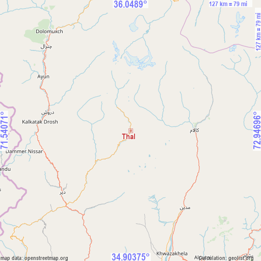
Thal GPS coordinates[2]
35° 28' 42.096" North, 72° 14' 37.788" East
| Map corner | latitude | longitude |
|---|---|---|
| Upper-left | 36.0489°, | 71.54071° |
| Center: | 35.47836°, | 72.24383° |
| Lower-right: | 34.90375°, | 72.94696° |
| Map W x H: | 127.3×127.3 km | = 79.1×79.1mi |
| max Lat: | 36.32162° ⇑1.1% North |
| Thal: | 35.47836° |
| min Lat: | ⇓98.9% South 24.14422° |
| min Long | Thal | max Long |
| 61.74573° | 72.24383° | 75.63372° |
| W 59.6%⇐ | ⇒40.4% E |
Elevation
Elevation of Thal is 2071 m = 6795 ft, and this is 1726 m = 5663 ft above average elevation for this country.
| Max E: |
2732 m = 8963 ft | 1.8% |
| Thal | 2071 m 6795 ft | |
| Avg. | 345 m = 1132 ft | |
Min E: |
3 m = 10 ft | 98.2% |
See also: Pakistan elevation on elevation.city.
Geographical zone
Thal is located in North temperate zone (between Tropic of Cancer and the Arctic Circle). Distance of this Northern Tropic circle is 1338.9 km =832 mi to South.| Distance of | km | miles | from Thal |
|---|---|---|---|
| North Pole | 6062.2 | 3766.9 | to North |
| Arctic Circle | 3456.4 | 2147.7 | to North |
| Tropic Cancer | 1338.9 | 832 | to South |
| Equator | 3944.8 | 2451.2 | to South |


Nearby cities:
15 places around Thal: (largest is in red/bold)
• Alpurai
71.4 km =44.4 mi,  150°
150°
• Bat Khela
98.8 km =61.4 mi,  194°
194°
• Battagram
113.9 km =70.8 mi,  141°
141°
• Chitral
58.6 km =36.4 mi,  315°
315°
• Daggar
109.8 km =68.2 mi,  168°
168°
• Dasu
97.1 km =60.3 mi,  102°
102°
• Kakad Wari Dir Upper
55.6 km =34.5 mi,  196°
196°
• Malakand
105.4 km =65.5 mi, 195°
• Mingora
78.5 km =48.8 mi, 172°
• Noorabad
138.7 km =86.2 mi, 190°
• Saidu Sharif
82 km =51 mi, 172°
• Shingli Bala
111.6 km =69.3 mi, 142°
• Tangi
141.6 km =88 mi, 202°
• Timargara
81.1 km =50.4 mi,  206°
206°
• Upper Dir
44.9 km =27.9 mi,  227°
227°
Sources, notices
• [Note1] Compared only with cities in Pakistan existing in our database
• [Src1] Map data: © OpenStreetMap contributors (CC-BY-SA)
• [Src2] Other city data from geonames.org with taken over terms of usage.
• [Src3] Geographical zone / Annual Mean Temperature by Robert A. Rohde @ Wikipedia
