Raja Jang geodata
Raja Jang (Punjab) is a populated place; located in Pakistan in Asia/Karachi (GMT+5) time zone. With population of 24,407 people, there are 244 cities with bigger population in this country. Compared to other cities in Pakistan, 56.2% of cities are located further ↓South; 93.5% of cities are located further ←West and 63% of cities have lower elevation than Raja Jang. Note1


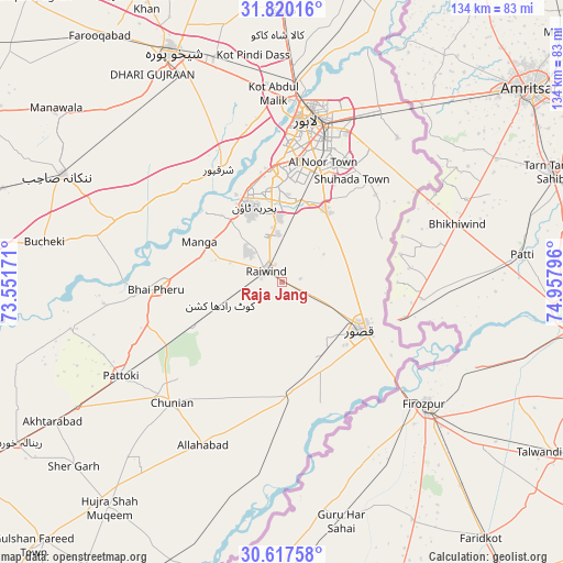
Raja Jang GPS coordinates[2]
31° 13' 14.808" North, 74° 15' 17.388" East
| Map corner | latitude | longitude |
|---|---|---|
| Upper-left | 31.82016°, | 73.55171° |
| Center: | 31.22078°, | 74.25483° |
| Lower-right: | 30.61758°, | 74.95796° |
| Map W x H: | 133.7×133.7 km | = 83.1×83.1mi |
| max Lat: | 36.32162° ⇑43.8% North |
| Raja Jang: | 31.22078° |
| min Lat: | ⇓56.2% South 24.14422° |
| min Long | Raja Jang | max Long |
| 61.74573° | 74.25483° | 75.63372° |
| W 93.5%⇐ | ⇒6.5% E |
Elevation
Elevation of Raja Jang is 213 m = 699 ft, and this is 132 m = 433 ft below average elevation for this country.
| Max E: |
2732 m = 8963 ft | 37% |
| Avg. | 345 m = 1132 ft | |
| Raja Jang | 213 m = 699 ft | |
Min E: |
3 m = 10 ft | 63% |
See also: Pakistan elevation on elevation.city.
Geographical zone
Raja Jang is located in North temperate zone (between Tropic of Cancer and the Arctic Circle). Distance of this Northern Tropic circle is 865.5 km =537.8 mi to South.| Distance of | km | miles | from Raja Jang |
|---|---|---|---|
| North Pole | 6535.6 | 4061 | to North |
| Arctic Circle | 3929.7 | 2441.8 | to North |
| Tropic Cancer | 865.5 | 537.8 | to South |
| Equator | 3471.4 | 2157 | to South |


Nearby cities:
15 places around Raja Jang: (largest is in red/bold)
• Chak Five Hundred Seventy-five
54.2 km =33.7 mi,  311°
311°
• Chunian
38.6 km =24 mi,  222°
222°
• Hujra Shah Muqim
67.3 km =41.8 mi, 217°
• Kahna Nau
19.6 km =12.2 mi,  33°
33°
• Kanganpur
52.3 km =32.5 mi,  193°
193°
• Kasur
21.8 km =13.5 mi,  121°
121°
• Kot Radha Kishan
15.6 km =9.7 mi,  249°
249°
• Lahore
38.6 km =24 mi,  13°
13°
• Mianke Mor
29.2 km =18.1 mi,  265°
265°
• Muridke
64.7 km =40.2 mi,  0°
0°
• Nankana Sahib
58 km =36 mi,  296°
296°
• Pattoki
44.2 km =27.5 mi,  239°
239°
• Raiwind
4.9 km =3 mi, 309°
• Sharqpur Sharif
30.5 km =19 mi,  331°
331°
• Shekhupura
60.4 km =37.5 mi, 334°
Sources, notices
• [Note1] Compared only with cities in Pakistan existing in our database
• [Src1] Map data: © OpenStreetMap contributors (CC-BY-SA)
• [Src2] Other city data from geonames.org with taken over terms of usage.
• [Src3] Geographical zone / Annual Mean Temperature by Robert A. Rohde @ Wikipedia
