Chunian geodata
Chunian (Punjab) is a populated place; located in Pakistan in Asia/Karachi (GMT+5) time zone. With population of 57,312 people, there are 119 cities with bigger population in this country. Compared to other cities in Pakistan, 54% of cities are located further ↓South; 89.8% of cities are located further ←West and 57.1% of cities have lower elevation than Chunian. Note1


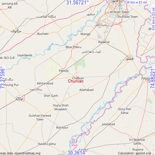
Chunian GPS coordinates[2]
30° 57' 58.356" North, 73° 58' 44.688" East
| Map corner | latitude | longitude |
|---|---|---|
| Upper-left | 31.56721°, | 73.27596° |
| Center: | 30.96621°, | 73.97908° |
| Lower-right: | 30.3614°, | 74.68221° |
| Map W x H: | 134.1×134.1 km | = 83.3×83.3mi |
| max Lat: | 36.32162° ⇑46% North |
| Chunian: | 30.96621° |
| min Lat: | ⇓54% South 24.14422° |
| min Long | Chunian | max Long |
| 61.74573° | 73.97908° | 75.63372° |
| W 89.8%⇐ | ⇒10.2% E |
Elevation
Elevation of Chunian is 195 m = 640 ft, and this is 150 m = 492 ft below average elevation for this country.
| Max E: |
2732 m = 8963 ft | 42.9% |
| Avg. | 345 m = 1132 ft | |
| Chunian | 195 m = 640 ft | |
Min E: |
3 m = 10 ft | 57.1% |
See also: Chunian elevation on elevation.city.
Geographical zone
Chunian is located in North temperate zone (between Tropic of Cancer and the Arctic Circle). Distance of this Northern Tropic circle is 837.2 km =520.2 mi to South.| Distance of | km | miles | from Chunian |
|---|---|---|---|
| North Pole | 6563.9 | 4078.6 | to North |
| Arctic Circle | 3958.1 | 2459.4 | to North |
| Tropic Cancer | 837.2 | 520.2 | to South |
| Equator | 3443.1 | 2139.4 | to South |


Nearby cities:
15 places around Chunian: (largest is in red/bold)
• Basirpur
45.2 km =28.1 mi,  197°
197°
• Dipalpur
45.3 km =28.1 mi,  223°
223°
• Hujra Shah Muqim
29.1 km =18.1 mi,  210°
210°
• Kahna Nau
58 km =36 mi,  39°
39°
• Kanganpur
26.3 km =16.3 mi,  148°
148°
• Kasur
48 km =29.8 mi,  69°
69°
• Kot Radha Kishan
25.5 km =15.8 mi,  27°
27°
• Mianke Mor
26.4 km =16.4 mi,  353°
353°
• Mustafābād
46.5 km =28.9 mi,  259°
259°
• Okara
53.2 km =33.1 mi,  250°
250°
• Pattoki
13.4 km =8.3 mi,  296°
296°
• Raiwind
38.7 km =24 mi, 35°
• Raja Jang
38.6 km =24 mi, 42°
• Renala Khurd
37.6 km =23.4 mi, 255°
• Sharqpur Sharif
56.2 km =34.9 mi,  11°
11°
Sources, notices
• [Note1] Compared only with cities in Pakistan existing in our database
• [Src1] Map data: © OpenStreetMap contributors (CC-BY-SA)
• [Src2] Other city data from geonames.org with taken over terms of usage.
• [Src3] Geographical zone / Annual Mean Temperature by Robert A. Rohde @ Wikipedia
